
Why Driving the Overseas Highway to Key West Feels Unlike Any Other Road
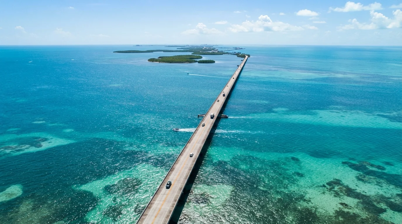
Photo credit: ExploreRoute.net | Travel Made Simple
In this article
The Florida Keys Overseas Highway spans 113 miles over open water, connecting the mainland to Key West across 42 historic bridges.
Key Takeaways
- The Overseas Highway runs 113 miles from Florida City to Key West across 42 bridges.
- It follows the path of Henry Flagler's Florida East Coast Railway, demolished by a 1935 hurricane.
- Seven Mile Bridge is the route's iconic centerpiece and one of the longest segmental bridges in the world.
- The highway passes through distinct island communities, each with its own character and ecology.
- Driving the route takes roughly two to three hours nonstop, but most travelers stop frequently along the way.
A Road Built on a Railroad's Ghost
Before the first car crossed open water to Key West, a train did. Henry Flagler's Florida East Coast Railway extended its tracks all the way through the Keys between 1905 and 1912, an engineering feat so audacious it earned the nickname "Flagler's Folly." When the Labor Day Hurricane of 1935 — one of the most powerful Atlantic storms ever recorded — dismantled much of the rail line, it ended an era. But the infrastructure wasn't abandoned. Engineers converted the rail corridor into what became the Overseas Highway, opening the full route in 1938.
That history sits just beneath the surface of every mile you drive. Many bridges you cross were originally built for locomotives. Old railway pilings still jut from the water alongside newer spans. Knowing this transforms the drive from a scenic commute into something closer to a living museum — a road that exists because of a catastrophe and a bold act of reinvention.
The Railroad That Became a Road
Henry Flagler's Florida East Coast Railway reached Key West in 1912 after seven years of construction across open water — an unprecedented feat at the time. The Labor Day Hurricane of 1935 destroyed the rail line beyond economical repair. Florida purchased the right-of-way and converted it into the Overseas Highway, which opened in 1938. The transformation means today's drivers are traveling, in many places, on bridges originally engineered for locomotives.
What Makes the Drive Physically Distinctive
Most American drives offer scenery alongside the road. The Overseas Highway puts you inside the scenery. For extended stretches — most dramatically across Seven Mile Bridge between Marathon and the Lower Keys — there is no land visible at all. Just water in every direction: the deep blue Atlantic to the east, the shallower jade of Florida Bay and the Gulf to the west.
113
Miles of highway from mainland to Key West
US Route 1 through the Florida Keys spans approximately 113 miles from Florida City to Key West.
42
Bridges crossed along the route
The Overseas Highway crosses 42 bridges, many built on original Flagler railway infrastructure from the early 1900s.
7 miles
Length of Seven Mile Bridge
Seven Mile Bridge, the route's centerpiece, stretches approximately seven miles over open water between Marathon and the Lower Keys.
The light changes constantly. Morning haze softens the horizon into watercolor. Midday sun turns the shallows neon turquoise. Late afternoon casts long gold light across the wave tops. Drivers often find themselves slowing involuntarily, not because of traffic, but because the view demands it.
The road itself is narrow — two lanes through much of its length — which creates a sense of intimacy with the water that a wider highway would eliminate. There are no shoulders to hide behind. You are, simply, out there.
Island Communities Worth Slowing Down For
The Keys are not a single destination — they're a loosely strung collection of distinct communities, each worth a pause. Key Largo, the first island encountered, is the gateway to the only living coral reef system in the continental United States, protected within John Pennekamp Coral Reef State Park. Islamorada bills itself as the "Sport Fishing Capital of the World" and carries a reputation for laid-back, salt-weathered charm. Marathon sits roughly at the highway's midpoint and offers access to the Crane Point Hammock nature preserve and the Florida Keys Aquarium Encounters.
Further south, Bahia Honda State Park presents one of the finest natural beaches in Florida — and a view of the old Bahia Honda Rail Bridge, its rusting iron span now closed to traffic but still photogenic against the sky. Then comes the Lower Keys, quieter and less developed, before the highway delivers you into Key West's famous collision of conch houses, sunset rituals, and literary history.
Drive South, Return North — Strategically
Driving southbound in the morning puts the sun behind you and the best water views to your left (east side). On the return trip north, late afternoon light illuminates the Gulf side beautifully. Splitting the trip across two days with an overnight in Marathon or Islamorada lets you experience both directions in ideal light conditions.
Practical Things to Know Before You Go
The Overseas Highway is a genuine two-lane road with limited overtaking opportunities, and traffic during winter season can stack up considerably — especially at the entrance to Key West. Plan for a full day if you intend to stop, and consider driving south on a weekday to avoid the worst of weekend congestion.
Gas stations and services thin out significantly south of Marathon, so fill up before crossing Seven Mile Bridge if you're running low. Cell coverage can be spotty in the Lower Keys. Hurricane season runs June through November; always check the National Hurricane Center and Florida road condition resources before traveling during those months.
Finally, respect the ecosystem. The Florida Keys National Marine Sanctuary surrounds most of this route. Speed limits in the water matter for manatees and sea turtles, and "no wake" zones near marinas are strictly enforced. The highway's magic is inseparable from the health of the water it crosses — treat it accordingly.
Frequently Asked Questions

Author
Road Trip Culture Editorial Team
Road Trip Culture Editorial Team is the collective byline for our editorial team and contributor network. Articles published under this byline or an editorial pen name are researched, written, and reviewed according to our editorial standards for clarity, consistency, and independence before publication.
View all articles →