
The Going-to-the-Sun Road: Driving Through Glacier's Heart
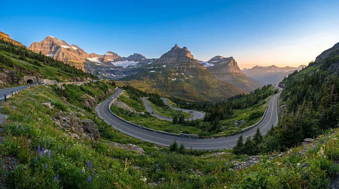
Photo credit: ExploreRoute.net | Travel Made Simple
In this article
Montana's most dramatic alpine road crosses the Continental Divide at Logan Pass. Learn what to expect before you make the ascent.
Key Takeaways
- Going-to-the-Sun Road is a 50-mile National Historic Landmark crossing the Continental Divide at Logan Pass (6,646 ft).
- Vehicle size restrictions apply — vehicles over 21 feet long or 8 feet wide are prohibited on the central alpine section.
- A timed entry permit is required during peak summer season; plan and reserve well in advance.
- The road is typically fully open only from late June through mid-October, depending on snowpack.
- Wildlife is abundant — expect to slow for mountain goats, bighorn sheep, and bears near the roadway.
- Pullouts and named viewpoints reward patient drivers who take their time along the route.
Why This Road Is Different
Completed in 1932 after more than a decade of construction, Going-to-the-Sun Road is an engineering marvel as much as a scenic one. Carved largely by hand out of sheer granite, it climbs from the shores of Lake McDonald at roughly 3,150 feet to Logan Pass at 6,646 feet before descending to St. Mary Lake on the park's eastern side. The National Park Service designated it a National Historic Landmark in 1997 — one of the few roads in the United States to earn that distinction.
The road's character changes dramatically as you ascend. Dense cedar-hemlock forest on the west side gives way to subalpine meadows, then to bare rock and wind-scoured tundra near the pass. Understanding those shifts makes the drive richer. For a deeper look at how to read that kind of terrain as it changes around you, see our guide to reading a landscape from the driver's seat.
Consider the Park Shuttle System
The free Going-to-the-Sun Road shuttle connects all major trailheads and viewpoints during summer operating season. Riding it one direction and driving the other lets you keep your eyes off the road when you want to take in the scenery — and eliminates the Logan Pass parking scramble. Check the NPS website for current shuttle hours and stop locations before your visit.
What You Need Before You Go
Preparation is the difference between a smooth ascent and a frustrating one. The National Park Service imposes a vehicle size limit on the 16-mile alpine section between Avalanche Creek and the St. Mary Falls trailhead: no vehicle combination longer than 21 feet or wider than 8 feet (including mirrors). This rules out most full-size RVs and towed trailers. Check your exact vehicle dimensions before assuming you can make the full crossing.
During peak season — typically late May through early September — a timed-entry permit system is in effect for private vehicles. Permits are released through Recreation.gov and sell out quickly. Day-of passes are occasionally available at park entrances before 6 a.m. and after 3 p.m., but these are not guaranteed. Arriving without a permit during restricted hours means turning back.
What you will need
How to Drive the Road: Step by Step
The standard direction is west to east — starting near Apgar Visitor Center at the western park entrance and finishing at the St. Mary Visitor Center. This direction puts you on the cliff-edge outer lane with unobstructed views into the valley below, which most drivers prefer. Allow a full half-day at minimum; a full day lets you stop meaningfully at key pullouts and take at least one short trail.
Start at Apgar or West Glacier — Early
Begin your drive no later than 7 a.m. to beat midday congestion and secure a pullout spot at popular viewpoints. Fill your fuel tank before entering the park; there are no gas stations on Going-to-the-Sun Road itself. Stop briefly at Apgar Visitor Center to pick up a current road conditions sheet and confirm whether any sections are under construction or temporarily closed.
Drive the Lake McDonald Valley
The first stretch follows Lake McDonald's eastern shore through old-growth cedar and hemlock. The forest here is unusually lush for a Rocky Mountain park — a product of heavier precipitation on the park's west side. Pull into the Lake McDonald Lodge turnoff for a five-minute walk to the shoreline; the reflections of Stanton and Vaught Mountains are a classic Glacier composition.
Stop at Avalanche Creek
Avalanche Creek marks the upper end of the vehicle-size restriction zone and is the trailhead for Trail of the Cedars, a flat, accessible boardwalk loop through old-growth forest and a narrow red-rock gorge. Even a 20-minute walk here resets your perspective before the road begins its serious climbing. This is also a common black bear sighting area — scan the treeline as you walk.
Climb to The Loop and Gain the Alpine
Above Avalanche Creek the road begins its signature ascent, switchbacking up the Garden Wall — a knife-edge arête carved by glaciers on both sides. The Loop is a large hairpin turn with a sizable parking area and one of the best views back down into the McDonald Valley. This is also a trailhead for hikers heading toward Granite Park Chalet. Take your time navigating the tight curve; oncoming RVs and buses require both lanes to be patient.
Cross Logan Pass and Explore the Divide
Logan Pass Visitor Center sits directly on the Continental Divide and is the emotional centerpiece of the drive. Park here (spaces fill by 8 a.m. on peak summer days) and walk the Hidden Lake Overlook Trail — a 2.7-mile round-trip boardwalk and gravel path through alpine meadows routinely patrolled by mountain goats and their kids. The pass itself offers sweeping views in both directions and a stark reminder of how recently glaciers shaped this landscape.
Descend the East Side to St. Mary
The eastern descent is faster and more open — broad U-shaped valleys carved by glaciers replace the dramatic cliffs of the west. Jackson Glacier Overlook is a signed pullout where you can see one of the park's few remaining named glaciers from the road. The landscape becomes increasingly windswept and prairie-influenced as you approach St. Mary Lake. Finish at the St. Mary Visitor Center, where rangers can suggest hiking options if you have remaining daylight.
Viewpoints, Wildlife, and Road Etiquette
The road includes numerous named pullouts — Avalanche Creek, The Loop, Bird Woman Falls Overlook, and the Big Bend are among the most rewarding. Wildlife congregates near the road year-round; mountain goats are regularly spotted at Logan Pass and along the upper cliffs. When animals appear near traffic, park only in designated pullouts and never approach or feed wildlife. Stopping in the travel lane creates dangerous bottlenecks on a road with little shoulder and steep drop-offs.
Afternoon thunderstorms are common in summer. Watch the sky as you climb; conditions can shift within minutes above treeline. The park's shuttle system runs the full length of the road during operating season and is a practical alternative if you'd rather not manage driving and wildlife-watching simultaneously.
Road Closures Can Happen Without Warning
Rockslides, sudden snowstorms, and emergency wildlife incidents can close sections of the road at any time, even in midsummer. Always check NPS road status at the park's official website or by calling the park information line the morning of your drive. Have a backup plan — many of Glacier's best experiences are accessible from roads that don't cross the Divide.

Author
Road Trip Culture Editorial Team
Road Trip Culture Editorial Team is the collective byline for our editorial team and contributor network. Articles published under this byline or an editorial pen name are researched, written, and reviewed according to our editorial standards for clarity, consistency, and independence before publication.
View all articles →