
Reading a Landscape from the Driver's Seat: What to Notice on a Scenic Drive
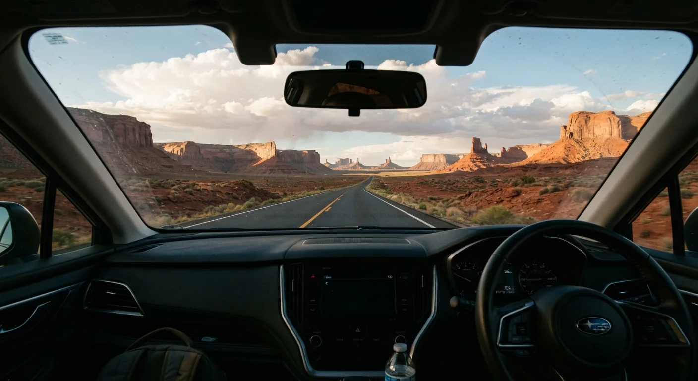
Photo credit: ExploreRoute.net | Travel Made Simple
In this article
Geology, agriculture, and ecology tell a story through every windshield. Learn what to look for as the terrain shifts beneath you.
Key Takeaways
- Rock color and layering visible from the road reveal millions of years of geological history.
- Vegetation transitions — especially sudden ones — signal changes in elevation, soil type, or moisture.
- Agricultural patterns visible from a highway reflect regional climate, soil quality, and local economy.
- River bends, valley floors, and ridge lines tell a story of erosion and water movement over time.
- Human-made features like fence lines, orchards, and road cuts are landscape clues too.
- Slowing down — even slightly — dramatically improves what you're able to observe and retain.
The Windshield as a Learning Frame
Most of us spend scenic drives in passive appreciation mode — something beautiful is out there, and we're glad it exists. But the terrain rolling past your windows is actively communicating, in the language of geology, ecology, hydrology, and human settlement history. Learning a bit of that language changes the whole experience.
You don't need a science degree. You need a framework — a set of questions to ask as the scenery shifts. Why is that rock red? Why does the forest suddenly thin out? Why is this valley so flat? Each answer pulls you deeper into the story of a place, and that story is almost always more interesting than the view alone. As driving more slowly and deliberately makes clear, speed is the enemy of observation — but even a modest reduction in pace creates space to engage.
Keep a Simple Field Notebook
You don't need to identify every species or name every formation precisely. Jotting quick notes — 'red rock starts here,' 'cottonwoods follow the creek,' 'farms give way to scrub' — creates a personal record of your route's landscape transitions. Over time, these notes build genuine pattern recognition that makes every subsequent drive richer.
Reading Geology Through Color and Form
Rock color is among the most readable signals in any landscape. The burnt reds and oranges of the Colorado Plateau reflect iron-rich sandstone deposited in ancient desert environments. The pale grays of limestone ridges in the Appalachians speak to ancient ocean floors, now lifted thousands of feet above sea level. Darker basaltic formations in the Pacific Northwest tell of relatively recent lava flows reshaping the land in geologically rapid time.
Layering is equally expressive. Horizontal bands of contrasting rock visible on a canyon wall or road cut (the exposed rock face created when a highway slices through a hillside) represent distinct geological eras stacked atop one another. A tilt in those layers means the earth has been pushed, folded, or faulted — evidence of tectonic forces on a massive scale.
Reading rock formations in wild landscapes in detail is a natural extension of what you can begin doing from the driver's seat — road cuts alone offer remarkable cross-sections of the earth's history at highway speed.
Road Cuts Are Roadside Museums
Many state geological surveys publish free road-cut guides keyed to specific highways, identifying exposed formations and their ages. These guides are written for general audiences and require no background in geology to use. They're among the most underused resources available to scenic drivers and can be found through state geological survey websites.
Vegetation as a Living Map
Plant communities respond to elevation, moisture, aspect (which direction a slope faces), and soil chemistry with remarkable precision. That precision makes them one of the most reliable reading tools available from a moving vehicle.
Watch for sudden transitions. When a dense stand of Douglas fir gives way to open ponderosa pine, you've likely crossed an elevation threshold or entered a rain shadow — the drier zone on the leeward side of a mountain range. When grassland abruptly becomes scrubland, suspect a soil change below the surface. When cottonwoods appear in a dry landscape, follow their line: water is close, either at the surface or just beneath it.
Color matters here too. In autumn, the geographic distribution of aspen groves becomes a topographic map in gold — aspens cluster in moist drainages and on north-facing slopes, painting a portrait of water movement across a hillside. In spring, blooming shrubs on south-facing slopes often precede the same species on north-facing slopes by two to three weeks, a reminder that aspect is a form of microclimate.
~12,000 ft
Elevation span of US plant zones
The United States spans hardiness and ecological zones from sea level to over 14,000 feet, meaning a single scenic drive can cross multiple distinct plant communities within hours.
500+ million
Years of geological record in US landscapes
Some exposed rock formations in the American Southwest and Appalachians preserve sedimentary and metamorphic records stretching back over 500 million years, readable from roadside outcrops.
Human Imprints on the Land
Agriculture visible from the highway is landscape reading in its most practical form. Circular green fields in the Plains states signal center-pivot irrigation systems drawing from aquifers below. The geometry of orchard rows — precise, linear, often on hillside slopes — indicates fruit or nut cultivation where drainage and air circulation matter. Terracing on steep slopes speaks to erosion management, sometimes practiced for generations.
Fence lines and road alignments are subtler but equally informative. Historic roads often follow terrain of least resistance — ridge tops, river valleys, or the edges between forest and meadow — because those were the routes animals used first, then people on foot, then wagons, and finally vehicles. When a modern highway seems to take a strangely indirect path, it's often echoing a much older logic.
Roadside landmarks and architecture tell America's story in exactly this way — built environments and transportation corridors together form a record of how people have understood and moved through a landscape over time. For drivers interested in going deeper before or after the drive, geographic clues that signal a hidden natural wonder expands on many of these same reading strategies. And if you're planning a new route, the scenic drive preparation checklist is worth reviewing before you head into unfamiliar territory.
Frequently Asked Questions

Author
Road Trip Culture Editorial Team
Road Trip Culture Editorial Team is the collective byline for our editorial team and contributor network. Articles published under this byline or an editorial pen name are researched, written, and reviewed according to our editorial standards for clarity, consistency, and independence before publication.
View all articles →