
Open-Source Intelligence for Travelers: Using Publicly Available Data to Know a Place
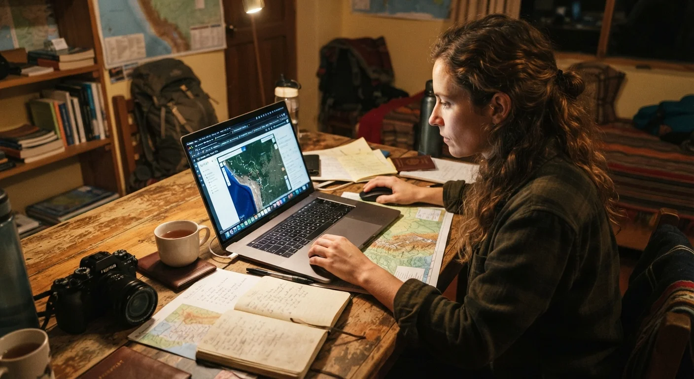
Photo credit: ExploreRoute.net | Travel Made Simple
In this article
Government datasets, satellite tools, academic papers, and news archives can all reveal things no travel site will. Here's how to use them.
Key Takeaways
- Government datasets, satellite tools, and academic sources reveal destination details that travel sites rarely publish.
- OSINT methods used by journalists and researchers translate directly into smarter pre-trip investigation.
- Combining multiple public data sources gives a more accurate picture than any single guide or review platform.
- Satellite imagery, air quality indices, and port authority records are all freely accessible to any traveler.
- Cross-referencing sources helps identify outdated, biased, or commercially motivated information before it misleads you.
Why Travelers Should Think Like Intelligence Analysts
Open-source intelligence — commonly abbreviated as OSINT — refers to the practice of gathering actionable information from publicly available sources. Journalists, security researchers, and policy analysts use it routinely. Frequent travelers can, too.
The gap between what a polished destination guide tells you and what a place is actually like on a given day can be significant. Popular destination guides go stale faster than most travelers realize — and the difference is filled by direct engagement with primary, publicly available data. That means government portals, satellite platforms, academic literature, and regional news archives, not just review aggregators. Crowd-sourced platforms have real value but carry structural blind spots that primary sources can correct. The methods below are practical, free, and learnable.
Mine Government Open Data Portals
Most national and regional governments publish open data portals covering everything from crime statistics and infrastructure investment to environmental monitoring and public health indicators. In the United States, data.gov and individual state portals offer downloadable datasets. The European Union's open data portal covers member states comprehensively. Many city governments publish neighborhood-level data including traffic counts, business permit activity, and noise complaints.
For travelers, this translates into practical intelligence: business permit density can signal a neighborhood in transition; infrastructure investment data can indicate which transit corridors are being upgraded; public health records can flag known environmental issues near tourist areas. Cross-referencing multiple datasets from the same region produces a layered picture no travel article will replicate.
Business permit data and infrastructure investment records reveal neighborhood trajectories no travel blog will mention.
Use Satellite and Aerial Imagery Critically
Satellite platforms such as Google Earth, Sentinel Hub (operated by the European Space Agency), and NASA's Worldview provide free access to time-series imagery that lets you track how a place has changed over months or years. Coastal erosion, construction activity, flood plain extent, and forest loss are all legible from orbit.
For practical trip planning, use historical imagery to assess a beach's actual sand extent at different times of year, check whether a rural road is paved or dirt, or verify that an attraction you've seen in photos still exists in recognizable form. Digital mapping tools offer far more than directions when you know which layers to activate and how to read what you're seeing.
Time-series satellite imagery lets you verify a destination's physical conditions before you commit to an itinerary.
Search Regional News Archives
Local and regional journalism captures events and conditions that international travel media rarely covers: municipal infrastructure failures, seasonal flooding patterns, local protests, changes in opening hours for major sites, or new development controversies near a UNESCO-listed area. Many regional newspapers maintain searchable online archives going back several years.
Search in the destination's primary language when possible — machine translation tools are good enough for headline-level scanning. Prioritize news from the last 12 to 24 months. Look for recurring themes rather than single incidents, which gives a more accurate sense of structural conditions versus one-off events. Regional news archives are particularly useful for understanding what issues locals consider significant, which often diverges substantially from what travel media emphasizes.
Searching local news in the destination's own language uncovers conditions that English-language travel media routinely ignores.
Consult Academic and Think-Tank Research
University research centers, regional policy institutes, and international organizations publish working papers and reports on economic conditions, social dynamics, environmental risks, and infrastructure quality for destinations worldwide. Google Scholar, the World Bank's open data library, and JSTOR (which offers limited free access) are good starting points.
A World Bank report on water infrastructure in a specific region, or a university study on overtourism pressures in a coastal destination, can contextualize what you'll encounter on the ground far more rigorously than a travel influencer's summary. Academic sources also often include historical comparison, which reveals whether conditions are improving or deteriorating — information with direct bearing on trip planning decisions.
World Bank reports and university working papers contextualize destination conditions with rigor that travel media cannot match.
Track Real-Time Environmental and Air Quality Data
Several platforms aggregate real-time and historical air quality, weather, and environmental sensor data globally. IQAir, the World Air Quality Index project (waqi.info), and Windy.com offer station-level air quality readings and forecast modeling. For destinations where seasonal smoke, dust events, or industrial pollution are possible concerns, checking historical air quality data during your intended travel window provides a meaningful health and comfort context.
Similarly, NOAA, Copernicus Climate Change Service, and national meteorological agencies publish climate normals — long-term statistical averages for temperature, precipitation, and humidity — that are more useful for planning than anecdotal accounts. Understanding that a destination has a 70% precipitation frequency in a given month is more actionable than reading that it "can be rainy."
Historical air quality and climate normal data give planners a statistically grounded view of what conditions to actually expect.
Read Port Authority and Transportation Authority Records
For maritime destinations, port authority websites frequently publish operational data including vessel traffic statistics, facility development plans, and environmental compliance reports. These can reveal whether a port is being expanded (implying more crowds), whether infrastructure is aging, or whether there are environmental remediation efforts underway in the surrounding area.
Similarly, national and regional transportation authorities publish in-destination mobility data including scheduled service changes, road construction timelines, and reliability statistics for public transit systems. For cruise travelers and shore excursion planners, port authority records offer a level of operational specificity that general travel sites simply don't provide. See also our guide to the broader ports and shore life research process for complementary approaches.
Port authority records reveal expansion plans, environmental issues, and operational changes cruise travelers rarely learn about in advance.
Apply These Methods Before Every Trip
None of these techniques require specialized software or professional training — only patience and a willingness to move beyond the first page of search results. The most effective pre-trip researchers layer these approaches: satellite imagery establishes the physical context, government datasets add regulatory and statistical depth, and regional journalism fills in the texture of daily life.
Start with One Source, Then Cross-Reference
Resist the temptation to open every data source simultaneously. Begin with the type of information most relevant to your trip's primary risk or uncertainty — environmental conditions, transportation reliability, neighborhood dynamics — and build outward from there. When two independent sources agree on a condition, your confidence in that information should increase substantially. When they conflict, dig into why: dates, methodology, and geographic scope often explain the discrepancy.
For cruise travelers, these methods are especially valuable when preparing for lesser-known stops. Our guide to researching a port you've never visited applies many of the same principles at a destination-specific level. Road trip planners scouting hidden scenic drives will also find satellite and terrain data particularly useful for pre-drive route assessment.
Understanding how to interpret what you find matters as much as finding it. A high crime-report count in a national database means something different in a densely populated city center than in a small coastal town. Context — drawn from local journalism, academic regional studies, and official government commentary — is what turns raw data into genuine insight.

Author
Travel Planning Editorial Team
Travel Planning Editorial Team is the collective byline for our editorial team and contributor network. Articles published under this byline or an editorial pen name are researched, written, and reviewed according to our editorial standards for clarity, consistency, and independence before publication.
View all articles →