
Reading Ancient Ruins Without a Tour Guide
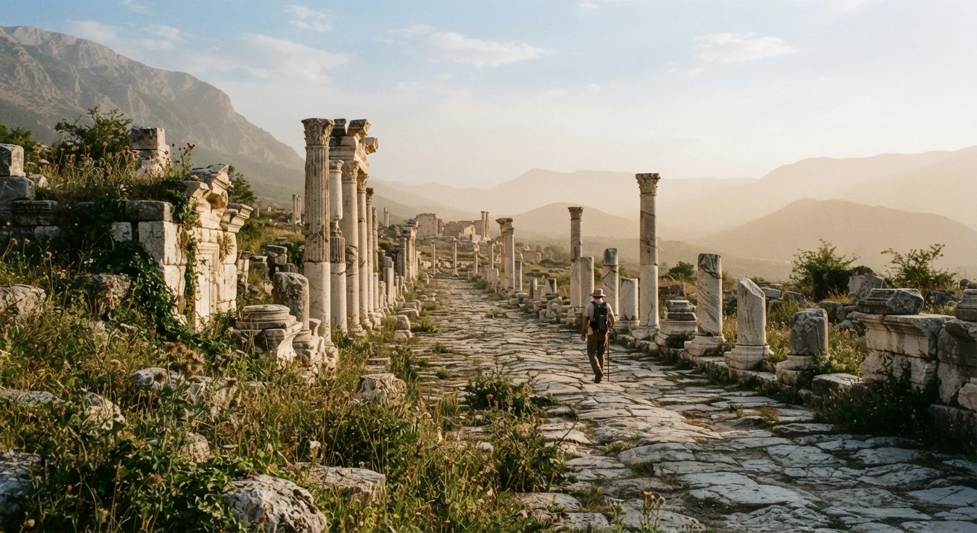
Photo credit: ExploreRoute.net | Travel Made Simple
In this article
Learn how to interpret stonework, street grids, and architectural remains so that a crumbling site tells its own story when you visit.
Key Takeaways
- Stone construction quality and material sourcing reveal a settlement's wealth and political reach.
- Street grid orientation and spacing are reliable indicators of civic planning and social hierarchy.
- Water infrastructure — cisterns, channels, drains — often survives best and tells the most about daily life.
- Threshold wear patterns and doorway placement indicate how people moved through and used a space.
- Comparing ruin layers helps distinguish phases of occupation, abandonment, and reuse over centuries.
Why Ancient Ruins Are Legible — If You Know What to Look For
Most travelers at a ruin site without a guide experience the same thing: a scatter of walls, some numbered stones, and a creeping sense that the meaning is locked somewhere out of reach. That feeling is almost always wrong. Ancient builders left their intentions embedded in the physical choices they made — the size of a block, the width of a street, the depth of a drain — and those choices remain readable centuries later once you understand the vocabulary.
This is not about having an archaeology degree. It is about slowing down long enough to ask systematic questions of the material in front of you. The steps that follow give you a framework for doing exactly that at any ruin you visit, whether it is a well-documented Roman city or an off-radar pre-Columbian settlement that receives a few hundred visitors a year.
Before diving into methodology, a note on preparation: the quality of your on-site reading scales directly with the research you do beforehand. The guide to planning your first visit to an off-radar archaeological site covers permits, local access logistics, and how to locate scholarly resources for lesser-known sites — all of which feed directly into your ability to interpret what you see.
What you will need
Tools That Make the Difference
You do not need expensive equipment to read a ruin effectively, but a few practical items sharpen your observations considerably. Most are things you likely already carry or can prepare easily before departure.
Compass
Helps you orient a site plan and understand the cardinal alignment of streets, temples, and civic spaces.
Published site plan or schematic
Provides a spatial framework that makes individual wall sections and room clusters immediately interpretable.
Notebook and pencil
Lets you sketch spatial relationships, annotate observations, and record details that photographs flatten.
Regional archaeology guide or monograph
Supplies cultural and historical context that field signage — where it exists at all — rarely provides in depth.
Hand lens (loupe)
Allows close inspection of mortar joints, tooling marks, and stone surface texture without touching fragile material.
Bring a Site Plan When You Can
Many archaeological sites — even obscure ones — have published plans in regional journals, national heritage databases, or university library archives. Downloading a schematic before you go transforms an apparently random scatter of walls into a legible plan you can walk through with genuine comprehension. The field-ready reference for independent travellers lists key sources worth checking in advance.
Step-by-Step: How to Read a Ruin
The following sequence works across site types — urban, ceremonial, domestic, military — and can be compressed for a short visit or expanded into a full day of structured observation. Adapt the depth to the time you have and the complexity of the site.
Never Disturb What You Find
Touching, moving, or removing any stone, artifact, or debris — even loose fragments — is illegal at most protected sites and can destroy irreplaceable context for researchers. The position of an object within a ruin is often as significant as the object itself. Always check site rules before visiting, and consult the responsible ruin visiting guide for ethical practices.
Orient Yourself Before You Enter
Stand at the site's edge — or at its highest accessible point — before walking in. Identify the cardinal directions and note how major walls, pathways, or platforms align with them. Many cultures oriented significant structures deliberately: toward solstices, prevailing winds, water sources, or defensive sightlines. A street grid running precisely north-south suggests centralized civic planning; one that follows a ridge or riverbank suggests organic growth constrained by terrain. This overview moment reframes everything you'll encounter at ground level.
Read the Stonework for Social Clues
Construction quality is one of the most direct records of power and resource. Finely dressed ashlar blocks — cut flat, fitted without mortar, or with near-invisible joints — indicate wealth, skilled labor, and often political authority. Rougher rubble walls bound with thick mortar suggest domestic or peripheral construction. Notice where the best stonework concentrates: at a central platform, a gateway, a large open courtyard. That concentration almost always marks the political or ceremonial core of the settlement.
Look also at stone origin. Where rock types differ visibly from the local geology, material was transported — a significant investment that signals importance. Running your eye along a wall's courses (horizontal layers) reveals repair episodes: a change in block size, mortar color, or tooling style marks a later rebuild, often after conflict, earthquake, or a change in governance.
Follow the Water Infrastructure
Cisterns, channels, drains, and fountain bases survive at ruin sites with remarkable frequency because they were built to last and buried quickly by sediment. Locating water infrastructure on your site plan — or simply following channels downslope — tells you where population density was highest, which areas were cultivated, and how administratively sophisticated the society was. A complex gravity-fed distribution network implies centralized engineering management; individual household cisterns cut into bedrock suggest a more decentralized or later-period occupation.
Cistern placement often marks the functional center of a neighborhood cluster. Working outward from cisterns is a reliable way to reconstruct the daily geography of a site when formal signage is absent.
Interpret Doorways and Thresholds
Doorways are among the most information-dense elements at any ruin. Width indicates the type of traffic expected: narrow entries served pedestrians only; wide, reinforced openings accommodated carts or livestock. Worn depressions in threshold stones show where feet fell most heavily — and therefore where the main circulation path ran, regardless of what walls now stand. Pivot holes cut into thresholds or lintels confirm that doors existed and suggest a space that was controlled or private rather than open and public.
Multiple doorways aligned across a series of rooms indicate processional or ceremonial movement — common in administrative buildings, temples, and elite residences. A single entrance facing away from prevailing winds or summer sun was more likely a domestic shelter than a civic building.
Identify Occupation Layers and Site Phasing
Most significant ruins are not a single moment frozen in time — they represent centuries of accumulation, alteration, and reuse. Where one wall cuts through or sits directly atop another, the overlying wall is later. Where floor levels differ between adjacent rooms, earlier rooms were often partially backfilled to create a raised platform for a newer structure above.
Look for signs of deliberate reuse: Roman columns repurposed as bridge piers in a medieval settlement; Islamic-era plasterwork applied over Byzantine mosaic floors; Colonial stonework built directly into pre-Columbian foundations. These palimpsests — places where one culture has overwritten another — are among the richest interpretive moments a ruin offers, and they are readable without specialist training once you know to look for the joins.
Synthesize What You've Observed Into a Narrative
After moving through the site, find a quiet spot — a low wall, a shaded corner — and review your notes and sketches. Where was the political center? Where did ordinary people live and work? Where did water flow and why? What phases of rebuilding can you trace? This synthesis step transforms disconnected observations into a coherent story of how the place functioned, changed, and eventually fell out of use.
Cross-reference your on-site reading with regional scholarship when you return. The independent traveller's field reference is a good starting point for building that contextual library before and after any visit.
Uneven Ground and Structural Risk
Ancient ruins often have concealed drops, unstable stonework, and subsurface voids. Moving slowly, watching your footing, and staying off elevated walls or unsupported arches is not overcaution — it is basic safety. Before visiting any remote or unmaintained site, review the pre-visit checklist for safety and access guidance.
Taking Your Interpretation Further
Reading a ruin independently does not mean reading it in isolation. The pre-colonial urban ruins of Africa offer a compelling case study in how sites that look initially opaque reward patient, structured observation — and how decades of underrepresentation in mainstream travel have left their stories underappreciated.
Similarly, if your interests extend to sites where human construction and natural geology intertwine, reading rock formations in wild landscapes uses analogous interpretive techniques drawn from geology rather than archaeology.
Whatever site you visit, the single most important habit you can develop is returning to it — in person if possible, or through scholarship — after your initial reading. First impressions at a ruin are rarely wrong, but they are always incomplete. The story a site tells deepens with every informed look you give it.

Author
Hidden Destinations Editorial Team
Hidden Destinations Editorial Team is the collective byline for our editorial team and contributor network. Articles published under this byline or an editorial pen name are researched, written, and reviewed according to our editorial standards for clarity, consistency, and independence before publication.
View all articles →