
Planning Your First Drive Along the Natchez Trace Parkway
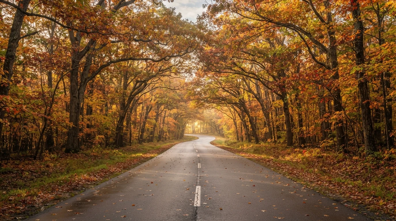
Photo credit: ExploreRoute.net | Travel Made Simple
In this article
Stretching 444 miles through Tennessee, Alabama, and Mississippi, the Natchez Trace rewards those who slow down and look closely.
Key Takeaways
- The Natchez Trace Parkway runs 444 miles from Natchez, Mississippi to Nashville, Tennessee.
- Commercial trucks, billboards, and traffic signals are prohibited, keeping the drive genuinely peaceful.
- The route passes through Indigenous heritage sites, Civil War landmarks, and old-growth forest.
- Most travelers spread the drive across two to four days to allow for meaningful stops.
- The speed limit is 50 mph throughout — this parkway rewards patience and curiosity.
What Is the Natchez Trace Parkway?
The Natchez Trace Parkway is a 444-mile scenic road administered by the National Park Service, threading through Tennessee, Alabama, and Mississippi. Its path follows an ancient travel corridor — first worn by Indigenous peoples, then used by European explorers, frontier traders, and Civil War troops — that predates the United States itself. Today it's one of the country's most quietly compelling drives.
What sets the Trace apart isn't just the history underfoot. Commercial vehicles are banned. Billboards don't exist. Traffic lights are absent. The road moves through dense hardwood forest, over quiet creeks, and past mounds built by pre-Columbian civilizations, all at a legally enforced 50 mph. The effect is genuinely unhurried — rare on American asphalt.
Natchez Trace
An ancient travel corridor in the American South used for centuries by Indigenous peoples and later by European settlers. The modern parkway follows its approximate historical path.
Parkway
A scenic roadway managed by the National Park Service, designed primarily for recreational driving rather than commercial or freight traffic. Billboards, trucks, and speed are restricted.
Milepost
Numbered markers placed along the parkway every mile, used to identify the location of landmarks, campgrounds, and pull-offs in NPS materials and signage.
Earthen Mound
A large structure built from compacted soil by pre-Columbian Indigenous civilizations, often used for ceremonial, religious, or civic purposes. Several significant mounds sit along the Trace.
Interpretive Pull-Off
A designated roadside stopping area with signage explaining the historical, ecological, or cultural significance of a nearby site.
Planning Your Route and Drive Time
The parkway runs from milepost 0 near Natchez, Mississippi, to milepost 444 near Nashville, Tennessee. You can begin from either end, and neither direction is superior — the character of the landscape simply shifts from river-bottom lowlands in the south to rolling cedar glades as you approach Tennessee.
A realistic first-timer itinerary spreads the drive across two to four days. Three days is a popular pace: one to explore the southern third around Natchez and Port Gibson, one through central Mississippi near Tupelo, and a final day through Alabama and into Tennessee. If you're short on time, even a single-day section — say, Tupelo northward to the Tennessee border — is worth the detour. For guidance on structuring a trip that balances mileage with meaningful stops, see planning a route that rewards the journey.
Drive the Direction That Fits Your Trip
Starting in Natchez puts the richest Indigenous history at the beginning of your drive, building toward Tennessee's cedar glades and rolling hills. Starting in Nashville works well if you're flying in — you'll hit the parkway quickly from the city and wind down into the Mississippi delta. Either approach delivers the full experience.
Landmarks and Stops Worth Slowing Down For
The parkway is dense with interpretive pull-offs, each one labeled with a milepost and a short history. A few stand out as genuinely unmissable:
- Emerald Mound (Milepost 10.3): One of the largest pre-Columbian earthen mounds in North America, built by the ancestors of the Natchez people. Walking around its base gives a tangible sense of the civilizations that shaped this corridor long before European contact.
- Rocky Springs (Milepost 54.8): A ghost town swallowed by forest. A church, a safe, and a cemetery are all that remain of a once-prosperous antebellum community, reclaimed by Mississippi woods after the Civil War and the boll weevil.
- Tupelo National Battlefield (Milepost 259.7): A compact but significant Civil War site marking an 1864 battle that shaped the Union's supply line strategy in the western theater.
- Meriwether Lewis Site (Milepost 385.9): The gravesite of explorer Meriwether Lewis, who died at a nearby inn in 1809 under circumstances that remain historically debated. A small monument and quiet woodland setting make it a reflective stop.
The Deep South holds more than the Trace alone. If you find yourself captivated by this corner of the country, scenic drives in the Deep South covers bayou roads and pine-forest corridors that most travelers never discover.
A Note on Historical Complexity
The Natchez Trace passes through landscapes shaped by Indigenous displacement, the antebellum plantation economy, and the Civil War. Interpretive signage along the route engages with this history directly. Travelers who read the pull-off markers carefully will find a fuller, more honest picture of the American South than most scenic drives offer.
Practical Tips for First-Time Drivers
A few logistics will make the difference between a smooth trip and a frustrating one:
- Fuel up before you enter. There are no gas stations on the parkway. Map fuel stops in nearby towns before each day's segment — gaps between exits can be significant in rural Mississippi.
- Cell service is intermittent. Download offline maps before you leave. NPS also publishes a detailed parkway map available at ranger stations near each terminus.
- Respect the 50 mph limit. Rangers patrol regularly. More importantly, the limit exists because the road was designed for looking — pull-offs are frequent, and sudden wildlife crossings are common.
- Check campground availability ahead of time. NPS-operated sites along the route vary by season. Confirm hours, reservations, and amenities through the official National Park Service website before travel.
- Seasonality matters. Spring wildflowers (March through April) and fall foliage (October through November) represent peak visual rewards. Summer is humid but lush; winter is generally passable with minimal crowds.
The Natchez Trace doesn't demand you rush. That's the entire point. Pack a picnic, keep a field notebook, and let the mileposts unspool at whatever pace feels right.
No Commercial Services On-Route
The parkway has no gas stations, restaurants, or convenience stores. Plan your food, water, and fuel needs before entering each segment. In remote stretches of Mississippi, the nearest exit town may be 20 or more miles away.
Frequently Asked Questions

Author
Road Trip Culture Editorial Team
Road Trip Culture Editorial Team is the collective byline for our editorial team and contributor network. Articles published under this byline or an editorial pen name are researched, written, and reviewed according to our editorial standards for clarity, consistency, and independence before publication.
View all articles →