
Scenic Drives in the Deep South That Most Travelers Never Hear About
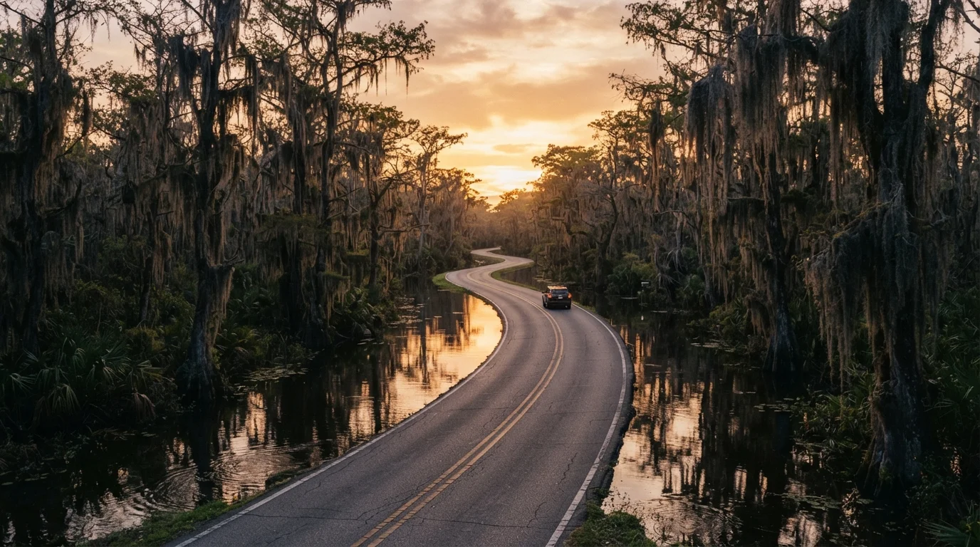
Photo credit: ExploreRoute.net | Travel Made Simple
Beyond Natchez Trace, the Deep South hides bayou roads, pine-forest corridors, and Gulf-coast backways worth exploring.
Key Takeaways
- The Deep South holds dozens of scenic drives beyond the well-known Natchez Trace Parkway.
- Bayou corridors, longleaf pine forests, and Gulf-coast backways each offer distinct character and landscapes.
- Many of these routes pass through living history — plantation country, Creole communities, and Civil Rights landmarks.
- Seasonal flooding and summer heat can affect road conditions; verify routes with state DOT resources before traveling.
- Venturing off marquee highways rewards travelers with solitude, local culture, and genuinely surprising scenery.
The Road Less Traveled Through the Deep South
When most travelers think of a Southern road trip, the Natchez Trace Parkway comes to mind almost immediately — and for good reason. But the Deep South's road network stretches far beyond that famous corridor, threading through river deltas, cathedral-like pine forests, and salt-marsh coastlines that rarely appear on anyone's bucket list. That obscurity is precisely the point.
Part of what makes these drives so compelling is that they resist being summarized. They tend to move slowly — not because the roads demand it, but because the landscape insists. A tangle of bayou just beyond the guardrail or a hand-lettered sign pointing toward a centuries-old church has a way of stopping you cold. These are routes worth approaching with curiosity rather than a schedule. For a broader framework on how to research and prepare for drives like these, see our guide to planning hidden scenic drives without a pre-packaged itinerary.
The five routes below stretch across Louisiana, Mississippi, Alabama, and Georgia, and each one offers something the iconic routes simply cannot — genuine quiet, authentic regional character, and the satisfying sense that you found it yourself.
Louisiana Highway 308: The River Road's Quieter Twin
Louisiana's River Road (Highway 18) on the west bank of the Mississippi gets most of the plantation-tourism traffic. Cross to the east bank and Highway 308 runs parallel through a nearly uninterrupted corridor of sugarcane fields, Creole cottages, and small Catholic churches with graveyards spilling toward the levee. The towns along this stretch — Napoleonville, Pierre Part, Paincourtville — feel genuinely lived-in rather than curated for visitors.
The drive between Donaldsonville and Thibodaux covers roughly 30 miles and rarely takes more than an hour, but plan for considerably longer. Side roads plunge into the Atchafalaya Basin fringe where cypress-tupelo swamps press against the pavement and great blue herons stand motionless in roadside ditches. This is one of the most ecologically rich landscapes in North America, and you can experience a significant slice of it from behind the wheel.
Highway 308 passes through sugarcane country and Creole towns almost entirely overlooked by traditional tourism.
Mississippi's Longleaf Trace: A Pine-Forest Corridor With History
Running roughly 41 miles between Hattiesburg and Prentiss, the Longleaf Trace follows an old rail corridor that was converted into a recreational path — but the parallel roads threading through the surrounding De Soto National Forest are equally worth driving. Mississippi's longleaf pine ecosystem once covered tens of millions of acres across the South; what remains is striking, and the forest near Hattiesburg and Purvis is among the better-preserved remnants.
Driving the county roads that lace through the national forest between US-98 and the trace gives you a sense of how vast and cathedral-like mature longleaf pine stands can be. The understory stays open — a product of the periodic burns that longleaf ecosystems depend on — which creates long sightlines beneath canopies of towering, straight-trunked pines. Wildflower diversity here is exceptional in spring, particularly for pitcher plants in the boggy seeps.
Mississippi's longleaf pine forest creates open, cathedral-like canopies rarely experienced by out-of-state travelers.
Alabama's Selma to Marion Scenic Byway
This roughly 30-mile corridor along Alabama Highway 14 between Selma and Marion carries weight that goes far beyond scenery. The road passes through the Black Belt region — named for its distinctive dark, fertile soil — and through small towns that were central to the Civil Rights movement of the 1960s. Marion was where Jimmie Lee Jackson was fatally shot by state troopers in February 1965, an event that directly precipitated the Selma to Montgomery marches.
The landscape itself is quietly dramatic: rolling prairie farmland, broad-sky vistas, and ancient oak trees arching over county roads. But the cultural and historical depth of this drive elevates it into something more profound than a scenic outing. Travelers interested in Civil Rights history will find interpretive resources in both Selma and Marion, and the drive between them offers genuine reflection time. Those drawn to overlooked regions with real cultural depth will find the Alabama Black Belt among the most rewarding in the country.
The Selma to Marion corridor combines Black Belt landscape with some of the most significant Civil Rights history in America.
Georgia's Jekyll Island Causeway and the Golden Isles Back Loop
Jekyll Island and the Golden Isles are not entirely unknown, but most visitors arrive by US-17 and stick to the island interiors. The real scenic payoff comes from the network of secondary roads threading through the salt marshes between Brunswick, Darien, and the coast — particularly along Georgia Highway 99, which hugs the inland waterway corridor through McIntosh County.
The marshes here are dominated by Spartina grass that shifts from bright green to amber gold depending on the season, and the light in late afternoon is genuinely extraordinary. Darien itself, one of the oldest continuously occupied European settlements in North America, warrants a stop. The combination of tidal creek crossings, dense maritime forest, and open marsh vistas makes this stretch a worthy counterpart to the better-known coastal backroads found along other American shorelines.
Georgia's salt-marsh backroads between Brunswick and Darien produce extraordinary tidal light that most coastal visitors never see.
Louisiana's Creole Nature Trail: Gulf-Coast Wilderness on Asphalt
Louisiana's Creole Nature Trail All-American Road is 180 miles of officially designated scenic byway in southwest Louisiana — yet it remains one of the least-driven officially recognized scenic routes in the country. The trail loops through Cameron Parish, passing through chenier ridges (ancient beach ridges forested with live oak), open prairie, and Gulf coastline before cutting back through freshwater marshes teeming with waterfowl.
The town of Holly Beach — sometimes called the Cajun Riviera — sits at the Gulf end of the loop and gives a glimpse of working Louisiana coastal culture entirely distinct from New Orleans or Baton Rouge. This drive is also a serious birding destination; the cheniers act as a critical stopover for migratory songbirds in spring and fall, and shorebird diversity along the Gulf edge is exceptional. Road conditions can be affected by hurricanes and seasonal flooding, so checking with the Louisiana Office of Tourism and the state DOT before travel is genuinely important here rather than just a formality.
The Creole Nature Trail is one of America's officially designated scenic byways — and one of its most underdriven.
Hit the Road With Eyes Wide Open
What unites these five drives is an unhurried quality that feels increasingly rare. You won't find billboard advertising for them at highway rest stops. Gas stations are sometimes miles apart. That's part of the bargain — and part of the reward. The Deep South's backroads belong to locals and to the landscape itself, and arriving as an attentive guest rather than a tourist checking boxes makes all the difference.
Plan Around Seasons and Weather
Summer in the Deep South brings intense heat and humidity, plus the peak of Atlantic hurricane season (June through November). Spring and fall offer the most comfortable driving conditions and — particularly in spring — remarkable wildflower and migratory bird activity. Low-lying roads in Louisiana and coastal Georgia can flood quickly after heavy rain, so always check local road condition reports before heading out on unfamiliar backways.
If your appetite for overlooked Southern routes has grown, the Deep South is also part of a wider pattern of discovery. Our complete guide to hidden scenic drives across the United States covers research methods, safety planning, and regional highlights from coast to coast. And if you find yourself drawn to coastal scenery, the Gulf backways here are just one chapter — coastal backroads beyond Pacific Coast Highway explores equally dramatic shoreline routes on both coasts.
Always verify current road conditions with state DOT resources and check official sources for any entry or safety advisories, particularly during hurricane season or periods of heavy rainfall when low-lying roads can flood with little warning.

Author
Road Trip Culture Editorial Team
Road Trip Culture Editorial Team is the collective byline for our editorial team and contributor network. Articles published under this byline or an editorial pen name are researched, written, and reviewed according to our editorial standards for clarity, consistency, and independence before publication.
View all articles →