
The Pacific Coast Highway's Most Overlooked Stretches
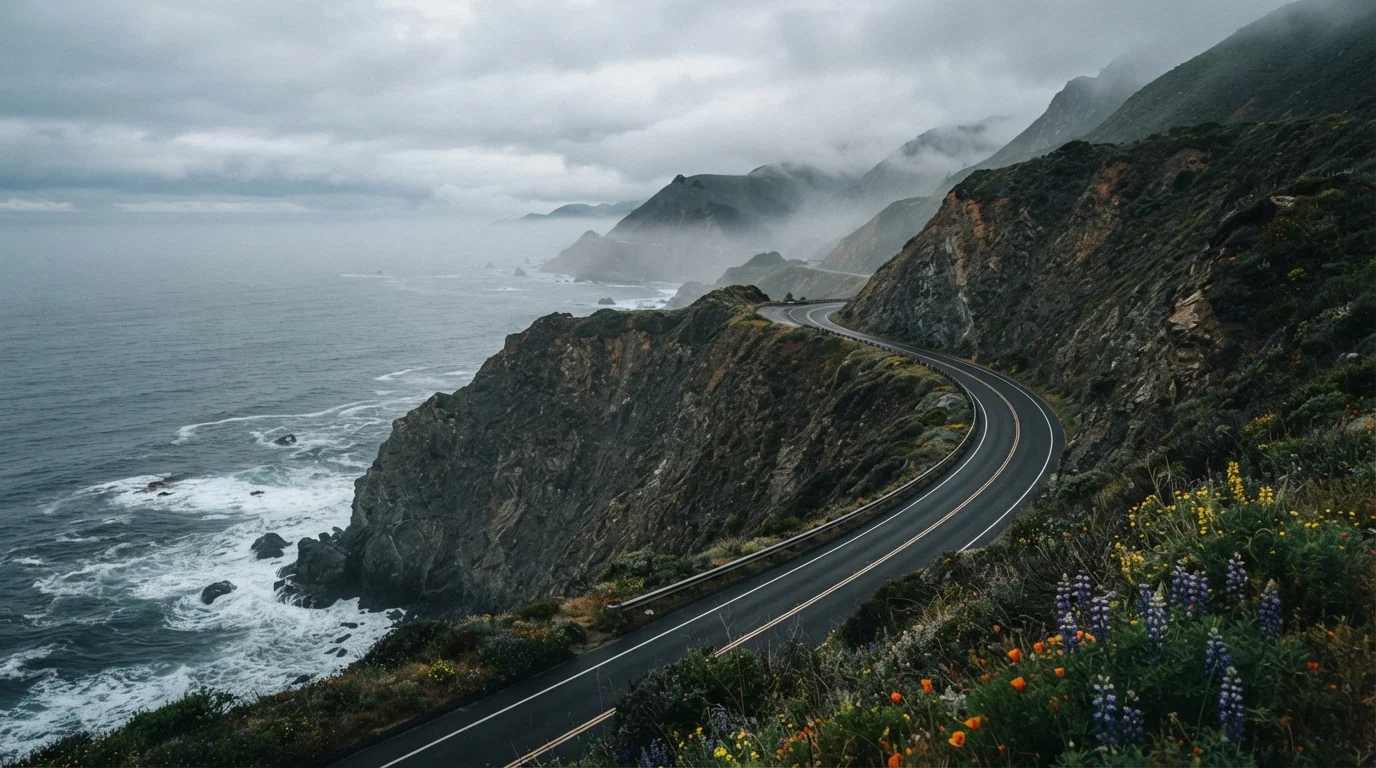
Photo credit: ExploreRoute.net | Travel Made Simple
In this article
Beyond the famous viewpoints, PCH hides quieter coves, forgotten fishing towns, and coastal bluffs most drivers speed right past.
Key Takeaways
- PCH's most rewarding stretches are often the quietest — not the most photographed.
- Small fishing towns, forgotten coves, and bluff-top pullouts reward drivers who slow down.
- Knowing where to exit the highway — and when — transforms a commute into a journey.
- Seasonal timing and tidal conditions meaningfully affect access to several of these spots.
- These overlooked segments connect historical threads that define California's coastal identity.
Why the Famous Views Aren't the Whole Story
Most PCH road trippers have the same mental highlight reel: Bixby Bridge, Malibu Colony, the 17-Mile Drive. These are genuinely spectacular — no argument there. But the 655-mile stretch of California 1 between Dana Point and Leggett contains far more texture than those marquee moments suggest. Drivers who treat the corridor as a connector between Instagram stops miss the fishing towns still operating on their own rhythms, the coves that don't appear in guidebooks, and the bluff-top pullouts with nobody else in sight.
Slowing down on PCH isn't just a romantic idea — it's a practical one. When you're not racing to the next famous overlook, you start noticing the highway's deeper character: the agricultural edge where coastal farms meet sea fog, the roadside dive that's been serving chowder since the 1950s, the turnout where brown pelicans stage by the hundreds. If you're weighing whether PCH or another legendary corridor suits your style, our comparison of PCH versus Route 66 can help you decide before you pack the car.
Access and Conditions Change Seasonally
Several spots mentioned in this article — particularly coastal coves and state beach day-use areas — have access restrictions that shift by season, tidal cycle, or weather event. California State Parks publishes current closure and conditions information online. Always check locally current conditions before planning access to remote or tidal areas, and follow posted signage on-site.
Overlooked Stretches Worth Your Full Attention
The Cambria Bluffs, San Luis Obispo County
Tucked between the Hearst Castle tourist rush to the north and the wine-country detours of Paso Robles to the east, the coastal bluffs directly west of Cambria get bypassed by most drivers. A network of maintained boardwalk trails runs along the cliff edge, offering unobstructed views of crashing surf, tidepools, and elephant seal haul-out beaches that rival — and often surpass — the more celebrated overlooks near San Simeon. The town itself is a genuine working community of artists and craftspeople, not a resort facade, with galleries and bakeries that have operated for decades.
Cambria's bluff walks deliver elephant seal views without the San Simeon parking-lot chaos.
Shelter Cove and the Lost Coast Approach, Humboldt County
Most PCH itineraries end around Leggett, where California 1 merges with US-101. But drivers who push north before that cutoff and detour onto Shelter Cove Road enter a genuinely remote stretch of California coastline — the southern edge of what's known as the Lost Coast. Black-sand beaches, volcanic headlands, and a tiny unincorporated community with a small harbor define this pocket. Cell service is minimal; the landscape is emphatic. Verify road conditions before heading out, as the access roads involve steep, winding grades.
The Lost Coast's southern approach is one of the most genuinely remote coastal drives in California.
Moss Landing, Monterey County
Positioned between Santa Cruz and Monterey, Moss Landing announces itself with a pair of towering power plant stacks visible from miles away — which is precisely why many drivers dismiss it as industrial scenery. That's a mistake. The Elkhorn Slough estuary here is one of California's most significant coastal wetlands, supporting sea otters, harbor seals, and hundreds of bird species in a setting that feels more Alaska than California. The small harbor still lands commercial fishing boats daily, and the antique row along Moss Landing Road is a legitimate destination for anyone who appreciates the weathered and the unexpected.
Moss Landing's power-plant silhouette hides one of California's richest coastal wetland ecosystems.
The Gaviota Coast, Santa Barbara County
Between Santa Barbara and Point Conception lies a 30-mile stretch of undeveloped coastline that California's coastal geography and land preservation battles have — largely by accident — kept free of commercial development. Gaviota State Park, Refugio State Beach, and El Capitan State Beach string together a corridor of sandstone bluffs, coastal sage scrub, and calm-water coves that feel anachronistic in the best sense. The long-running effort to protect Point Conception itself — a site considered sacred by Chumash people — gives this stretch a cultural depth worth understanding before you drive through it.
The Gaviota Coast is one of Southern California's last undeveloped coastal stretches, and it shows.
Bodega Bay to Jenner, Sonoma County
North of the Bay Area's gravitational pull, PCH re-emerges as California 1 through Sonoma County in a form that surprises most drivers who've only done the central coast. The short run from Bodega Bay — famous as Alfred Hitchcock's filming location for The Birds — up to the Russian River mouth at Jenner packs in harbor seal colonies, windswept dunes, fishing boat traffic, and a series of pullouts where you can watch the river push into the sea. The village of Jenner itself is a handful of buildings on a hillside, but the view down to the river mouth from the highway is one of the coast's most quietly arresting moments.
Jenner's river-meets-ocean panorama is one of PCH's most quietly arresting sights, with almost no crowd.
Time Your Drive for Shoulder Season
June through August brings heaviest traffic to PCH's famous sections. September and October offer cleaner air, better visibility, and noticeably thinner crowds on the overlooked stretches listed here. Spring wildflower season (March–April) is spectacular on the bluff segments but can bring more weekend traffic than weekday drivers expect. Whatever time of year you travel, morning departure times consistently outperform afternoon starts for both light and logistics.
Making the Most of These Miles
The overlooked segments of PCH reward a specific kind of traveler: one willing to trade schedule certainty for genuine surprise. Check tidal charts before visiting any cove or sea-stack beach — what's accessible at low tide may be unreachable two hours later. Seasonal fog is heaviest from late spring through early summer along the central and northern coast, which keeps crowds thin but also limits visibility; plan photo stops accordingly.
These stretches also pair well with the hidden scenic drives that branch inland from PCH — back roads through coastal ranchland and redwood corridors that most drivers never discover. For a broader framework on finding underrated drives anywhere in the country, the complete guide to hidden scenic drives covers research methods and regional highlights worth bookmarking. The overlooked towns you pass through on PCH also share a spirit with the underrated towns that reward curious travelers across the U.S. — places operating on their own pace, unbothered by the tourism machine one exit over.

Author
Road Trip Culture Editorial Team
Road Trip Culture Editorial Team is the collective byline for our editorial team and contributor network. Articles published under this byline or an editorial pen name are researched, written, and reviewed according to our editorial standards for clarity, consistency, and independence before publication.
View all articles →