
A Complete Guide to Discovering Hidden Scenic Drives Across the United States
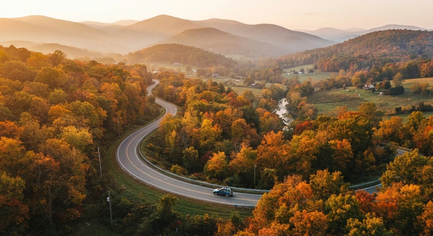
Photo credit: ExploreRoute.net | Travel Made Simple
In this article
Everything you need to find, plan, and experience underrated backroad drives — from research methods to regional highlights coast to coast.
Key Takeaways
- Lesser-known scenic drives often deliver richer landscapes and quieter experiences than crowded iconic routes.
- State DOT websites, national forest maps, and local visitor centers are among the most reliable discovery tools.
- Seasonal access, fuel availability, and road surface type vary widely — always verify before you go.
- America's Byways program designates routes beyond the famous ones; hundreds are undervisited.
- Slow down: the best backroads reward patience, spontaneity, and willingness to stop without a plan.
Why Underrated Drives Deserve Your Attention
America's road trip canon is well-established — Route 66, the Pacific Coast Highway, the Blue Ridge Parkway. These are genuinely spectacular, and we'd never argue otherwise. But for travelers who've done those miles or simply crave something less curated, the country's overlooked backroads offer something the famous routes increasingly struggle to provide: solitude, surprise, and a sense of genuine discovery.
Underrated drives aren't inferior drives. They're often maintained by state departments of transportation, pass through landscapes just as dramatic as their famous counterparts, and connect travelers with small towns and communities that see a fraction of the tourism traffic. The difference is visibility — and that's exactly what this guide addresses.
If you're curious how the celebrated routes compare, our hub on iconic American road trip corridors is a useful counterpoint. But if the pull of the unfamiliar is stronger, read on.
150+
Federally Designated Scenic Byways
The America's Byways program includes over 150 designated routes across 46 states, many of which attract far less traffic than their landscapes warrant.
~3M
Miles of Public Roads in the US
The U.S. has roughly 3 million miles of paved public roads, a vast majority of which never appear in mainstream road trip itineraries.
60%+
Travelers Preferring Off-Peak Routes
Survey research by travel industry analysts has consistently found a majority of frequent travelers express preference for less-crowded alternatives to marquee destinations.
How to Research Hidden Scenic Routes
Finding drives that don't appear in every travel magazine listicle takes a little more legwork — and a few underused resources most travelers don't think to consult.
Official Government Sources
State departments of transportation publish road condition reports, seasonal closure schedules, and sometimes scenic corridor maps. The Federal Highway Administration's America's Scenic Byways program designates hundreds of routes across multiple categories — All-American Roads, National Scenic Byways, and state-level designations — many of which see modest traffic despite their official recognition.
Topographic and Forest Service Maps
USDA Forest Service maps reveal unpaved forest roads and scenic corridors that never make it onto consumer navigation apps. Combined with topographic maps (available through the USGS National Map portal), these tools help you spot ridge routes, canyon roads, and river corridors worth investigating.
Local Knowledge
Gas station attendants, county historical societies, and small-town visitor centers often know the roads in their area better than any website. Ask specifically about drives that locals take — not what they recommend for tourists.
Search state tourism office websites for 'scenic byway' or 'heritage corridor' PDFs — these often list routes with mile markers and points of interest that never surface in a standard web search.
State tourism agencies maintain detailed route documentation specifically to encourage travel on lesser-known roads, making them a gold mine for drive discovery.
When you find a promising road on a map, zoom in on satellite view and check for pullout areas, grade changes, and water crossings — details that tell you whether the drive is accessible in your vehicle.
Satellite imagery reveals surface and terrain characteristics that road classifications alone don't communicate, helping you avoid surprises mid-route.
For a thorough walkthrough of the research process, see our guide to planning a hidden scenic drive without a pre-packaged itinerary, which covers topographic tools and DOT resources in depth.
Regional Highlights Worth Exploring
Every region of the United States holds drives that reward those willing to look beyond the obvious. The examples below are illustrative starting points, not exhaustive lists — consider them invitations to dig deeper.
The South and Appalachian Foothills
Beyond the Blue Ridge Parkway's well-traveled lanes, Appalachian foothills in Tennessee, Virginia, and North Carolina are threaded with state routes that climb through hardwood forests and dip into quiet river valleys. The underrated small towns along these routes often feature local crafts, working farms, and general stores that feel unchanged by decades.
The Great Plains and High Desert
Kansas, Nebraska, and eastern Wyoming offer something counterintuitive: drives across seemingly flat terrain that reveal subtle drama — the Sandhills of Nebraska, the Flint Hills tallgrass corridor, and the volcanic rim roads of Wyoming's high desert. The scale alone is humbling.
The Pacific Northwest Interior
While Oregon's coast draws crowds, the state's interior — the Wallowa Mountains, Hells Canyon rim roads, and the wheat-blanketed Palouse straddling the Idaho border — offers sweeping, uncrowded beauty accessible on paved two-lanes.
The Southwest's Secondary Roads
New Mexico and Arizona are laced with state highways and BLM roads that pass through canyon country, ancient ruins, and volcanic landscapes. These routes often connect to protected lands and national park areas, though the drives themselves travel through less-visited corridors.
“The road that goes somewhere worth going is rarely the one that everyone already knows about. The best discoveries happen when you're willing to follow a line on a map without knowing exactly where it leads.”
— Jonathan Raban, Travel writer and author of 'Bad Land: An American Romance'
Planning and Preparation Essentials
Hidden drives come with variables that well-trafficked routes typically don't. Planning accordingly isn't about being overly cautious — it's about staying flexible and safe so you can actually enjoy the experience.
- Road surface: Many scenic backroads are unpaved or subject to seasonal deterioration. Verify surface type and whether your vehicle's clearance and drive system are appropriate.
- Fuel range: Service stations can be 60 or more miles apart on remote drives. Know your tank's range and plan fill-ups conservatively.
- Cell service: Assume it won't exist. Download offline maps before departing and carry a paper backup.
- Seasonal access: Mountain passes, desert washes, and forest roads all have seasons — some close entirely for winter or monsoon conditions. Check with local ranger districts or state DOTs for current status.
- Water and supplies: Carry more than you think you'll need.
Our scenic drive preparation checklist covers these logistics in detail. For iconic route prep, this checklist applies many of the same principles. And if you're still in the trip-planning mindset, the complete trip research guide covers the full arc from first idea to final itinerary.
Don't Rely Solely on Navigation Apps
Consumer navigation apps frequently route drivers onto roads that are impassable for standard vehicles — washed-out forest tracks, private roads, or routes closed seasonally. Always cross-reference with official state DOT or Forest Service sources and download offline maps before entering areas with limited cell coverage.
Respecting the Road and the Places You Pass Through
The appeal of undiscovered drives comes with real responsibility. When a route gains popularity faster than local infrastructure can absorb, the very qualities that made it special erode quickly.
Leave-no-trace principles apply beyond trails — they extend to roadside pullouts, scenic overlooks, and the private land that borders many backroads. Stay on established pullouts, pack out everything you bring in, and avoid driving off-road or onto unmarked land.
In small communities along these routes, spend locally where you can: fuel, food, and accommodation from community businesses sustain the towns that give these drives their character. Ask before photographing people or private property, and be mindful of local customs and land-use traditions, particularly in Indigenous and rural agricultural communities.
The goal isn't to keep these places secret — it's to visit in a way that leaves them intact for the next traveler who finds them on their own terms.
Road conditions, access permissions, seasonal closures, and local regulations change frequently. Always verify current status through official state and federal sources before departing. This guide is for general informational purposes and does not guarantee conditions at the time of your travel.

Author
Road Trip Culture Editorial Team
Road Trip Culture Editorial Team is the collective byline for our editorial team and contributor network. Articles published under this byline or an editorial pen name are researched, written, and reviewed according to our editorial standards for clarity, consistency, and independence before publication.
View all articles →