
Natural Wonders at Risk: Sites That May Not Survive the Next Decade Unchanged
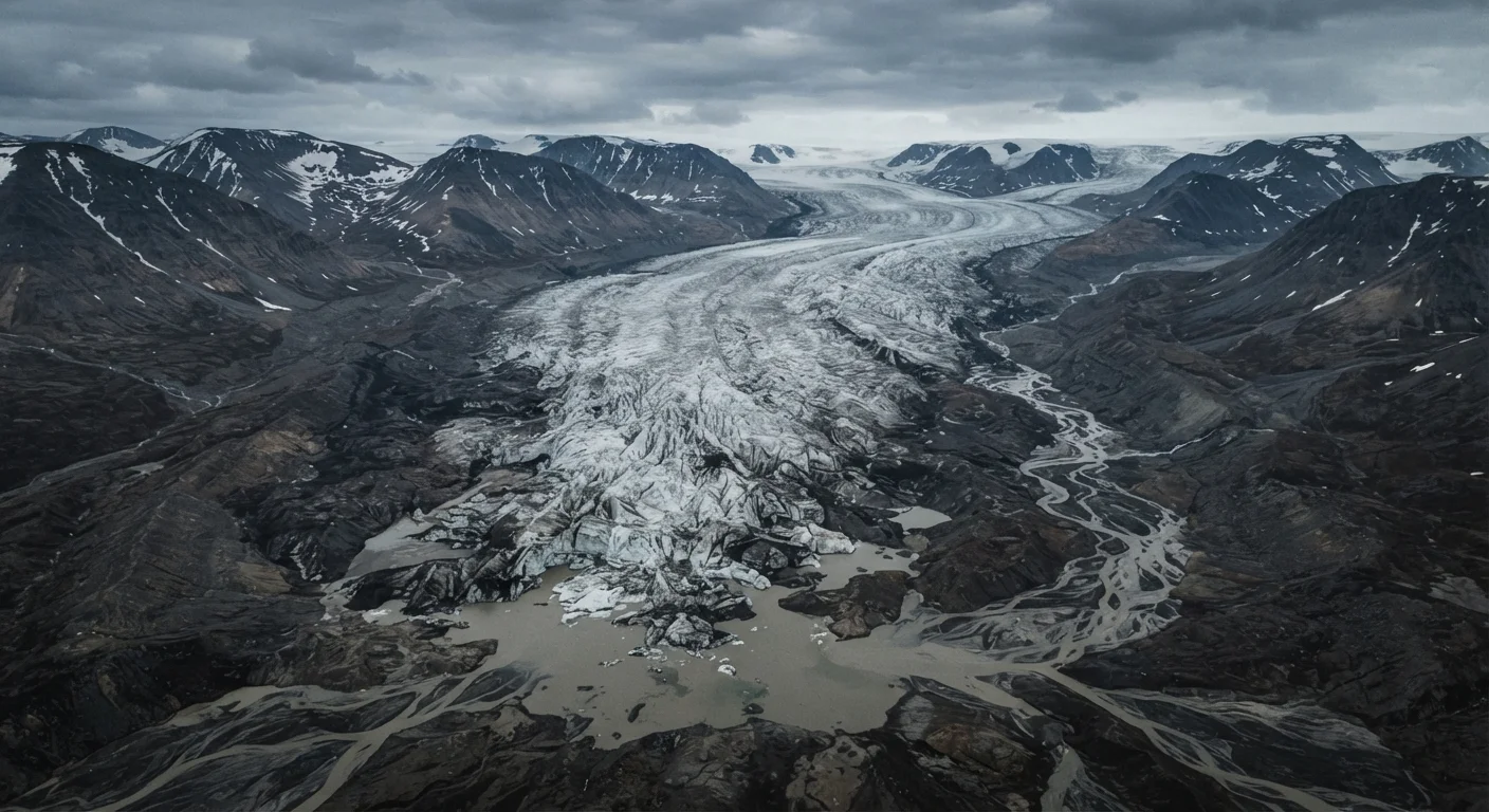
Photo credit: ExploreRoute.net | Travel Made Simple
Climate shifts, glacial retreat, and rising seas are quietly altering some of Earth's most extraordinary landscapes. Here's what the science indicates.
Key Takeaways
- Several iconic natural sites show measurable, documented change driven by warming temperatures and shifting precipitation patterns.
- Visiting fragile ecosystems carries ethical weight — responsible travel practices matter more than ever in these environments.
- Scientific monitoring is ongoing at each of these sites, and conditions should be verified with current sources before planning travel.
- Some changes are irreversible on human timescales, making the window to witness these landscapes in their current form genuinely finite.
- Supporting conservation organizations and low-impact tourism in these regions contributes meaningfully to preservation efforts.
The World Is Rewriting Its Own Geography
There is a particular kind of grief that travelers rarely anticipate: arriving at a place only to realize you are witnessing its slow disappearance. Across every continent, landscapes that took geological epochs to sculpt are now changing faster than at any point in recorded human history. The causes are complex — warming oceans, shifting rainfall cycles, permafrost thaw, bleaching events — but the effect on the ground is strikingly personal. You stand before something extraordinary, and somewhere beneath the wonder is the quiet recognition that future visitors may stand before something fundamentally different.
This isn't catastrophism. It's what the science indicates, and what park rangers, glaciologists, and marine biologists report from the field with increasing urgency. For the frequent traveler already familiar with the world's headline destinations, these sites represent a different kind of motivation — not bucket-list tourism, but bearing witness with intention.
Before visiting any of the places described here, we strongly encourage consulting responsible travel guidance for fragile ecosystems. The decisions individual travelers make — where they step, what they support, how they move through these places — carry real consequences in environments already under stress.
The Athabasca Glacier, Canadian Rockies
The Athabasca is one of the most studied and most visited glaciers in North America, partly because it sits alongside an accessible highway in Jasper National Park. It is also one of the most measurably retreating. Scientists have documented the glacier losing more than 1.5 kilometers in length since the early twentieth century, with the rate of retreat accelerating in recent decades. Interpretive markers along the access road show where the ice edge stood in previous years — a stark visual record that requires no scientific background to understand.
What visitors experience today — the blue-white compression of ancient ice, the cold breath of a river of frozen time — represents a window that the park's own interpretive materials acknowledge is narrowing. The Columbia Icefield, of which Athabasca is a remnant tongue, feeds major river systems across western Canada. Its loss is hydrological as much as visual.
Interpretive markers show ice retreat decade by decade — a timeline written directly into the landscape.
The Coral Triangle, Indo-Pacific
Stretching across waters shared by Indonesia, the Philippines, Malaysia, Papua New Guinea, the Solomon Islands, and Timor-Leste, the Coral Triangle is sometimes called the Amazon of the oceans. It hosts roughly 76 percent of all known coral species and supports the food security of hundreds of millions of people across the region. It is also among the marine ecosystems most acutely affected by warming seas.
Bleaching events — triggered when water temperatures rise above coral tolerance thresholds, causing corals to expel their symbiotic algae — have increased in frequency and severity across the triangle. Some reef sections recover between events; others, particularly where bleaching is compounded by local stressors like runoff and overfishing, do not. Scientists continue to monitor recovery rates with cautious attention to what the data actually shows rather than what observers might hope for.
The Coral Triangle holds 76 percent of all known coral species — and warming seas are testing that abundance.
Glacier National Park's Named Glaciers, Montana
When the park was established in 1910, it contained an estimated 150 glaciers large enough to be named and mapped. By the early 2020s, that number had dropped to roughly two dozen, with researchers projecting continued loss as warming trends persist. The park remains spectacularly beautiful — its carved valleys, turquoise lakes, and wildlife corridors are undiminished — but the feature for which it was named is disappearing within observable human lifespans.
The USGS Repeat Photography Project has documented this transformation through side-by-side historical and contemporary images that are freely available and deeply affecting. For travelers who appreciate landscapes with layered meaning, Glacier offers something rare: a place where the human relationship with geological time becomes viscerally, uncomfortably clear.
From 150 named glaciers in 1910 to roughly two dozen today — the math is impossible to overlook.
The Dead Sea Shoreline, Jordan and Israel
The Dead Sea is one of the most geologically distinctive bodies of water on Earth — the lowest point on the planet's surface, ten times saltier than ocean water, and fed historically by the Jordan River. Decades of river diversion for agriculture and municipal use have reduced inflow dramatically, and the sea has been shrinking at a rate of roughly one meter per year in recent measurements. The receding shoreline has left dramatic salt formations, sinkhole fields, and expanses of exposed lakebed that were submerged within living memory.
The transformation is extraordinary and, in a strange way, visually arresting — the exposed geology reveals layers of sediment and mineral formation rarely seen. But the ecological and cultural stakes are significant for the communities and ecosystems that depend on the basin. Several international proposals for replenishment projects have been studied over the years; their outcomes remain uncertain.
The Dead Sea has been shrinking at approximately one meter per year, exposing geology hidden for millennia.
Sundarbans Mangrove Forest, Bangladesh and India
The Sundarbans is the largest continuous mangrove forest in the world, sprawling across the Bengal delta where the Ganges, Brahmaputra, and Meghna rivers empty into the Bay of Bengal. It is a UNESCO World Heritage Site and the habitat of the Bengal tiger, Irrawaddy dolphin, and thousands of species of birds and fish. It is also one of the ecosystems most directly threatened by sea-level rise.
The delta region is both subsiding and experiencing increased cyclone intensity, and some low-lying islands within the forest have already been inundated. The mangroves themselves provide a buffer against storm surge that protects millions of people living in the broader delta — which means the forest's ecological vulnerability has direct human consequences. Researchers tracking the Sundarbans emphasize that its condition is not a single story but a mosaic of resilience and loss playing out unevenly across the delta.
The Sundarbans' fate as a storm buffer is inseparable from the lives of millions who live behind it.
Lake Titicaca's High Andean Wetlands, Peru and Bolivia
At nearly 3,800 meters above sea level, Lake Titicaca is the world's highest navigable lake and the center of one of South America's most historically rich landscapes. The totora reed wetlands along its shores have sustained Indigenous Uros communities for centuries, and the lake itself is a biodiversity hotspot for endemic fish and amphibian species found nowhere else on Earth.
Andean glaciers that feed the lake's tributary rivers are retreating, changing seasonal water flows and creating uncertainty around long-term water levels. The endemic Titicaca water frog, already critically endangered due to pollution and harvesting pressures, faces additional habitat stress as the aquatic environment shifts. The factors that keep certain wild places genuinely unknown often include physical remoteness — but Titicaca's challenges are not about obscurity. They are about the fragility of an ancient system operating at its limits.
Lake Titicaca's endemic species exist nowhere else — making every ecological shift here a global event.
Traveling With Eyes Open
None of these sites have vanished yet. That distinction matters. They remain extraordinary, scientifically significant, and in many cases still accessible — though entry requirements, seasonal access windows, and conservation restrictions vary and can change. Always verify current conditions, visa requirements, and any advisories with official government and park authority sources before planning travel.
Travel Timing and Seasonal Sensitivity
Several of the sites listed here have narrow or shifting access windows tied to seasonal conditions — monsoon timing, ice stability, or cyclone seasons. Always consult park authorities and official tourism bodies for current seasonal guidance before finalizing plans. For remote or high-risk environments, reviewing wilderness risk management strategies before departure is a worthwhile step.
The impulse to visit places before they change is understandable, but it comes with a caveat worth sitting with: high visitor pressure itself accelerates damage in fragile systems. If these places draw you in, consider how you travel as carefully as whether you travel. For destinations that remain genuinely remote and unmapped, our exploration of wilderness areas that rarely appear on any map offers a parallel conversation about access and responsibility.
What makes a place worth protecting is often the same thing that makes it worth visiting — its specificity, its irreplaceability, its deep geological or ecological story. If you want to understand what you're actually looking at when you stand inside these landscapes, reading rock formations in wild landscapes is a grounding place to start. These are not just beautiful places. They are records — and some of those records are being edited faster than we can read them.

Author
Hidden Destinations Editorial Team
Hidden Destinations Editorial Team is the collective byline for our editorial team and contributor network. Articles published under this byline or an editorial pen name are researched, written, and reviewed according to our editorial standards for clarity, consistency, and independence before publication.
View all articles →