
Wilderness Areas That Rarely Appear on Any Map
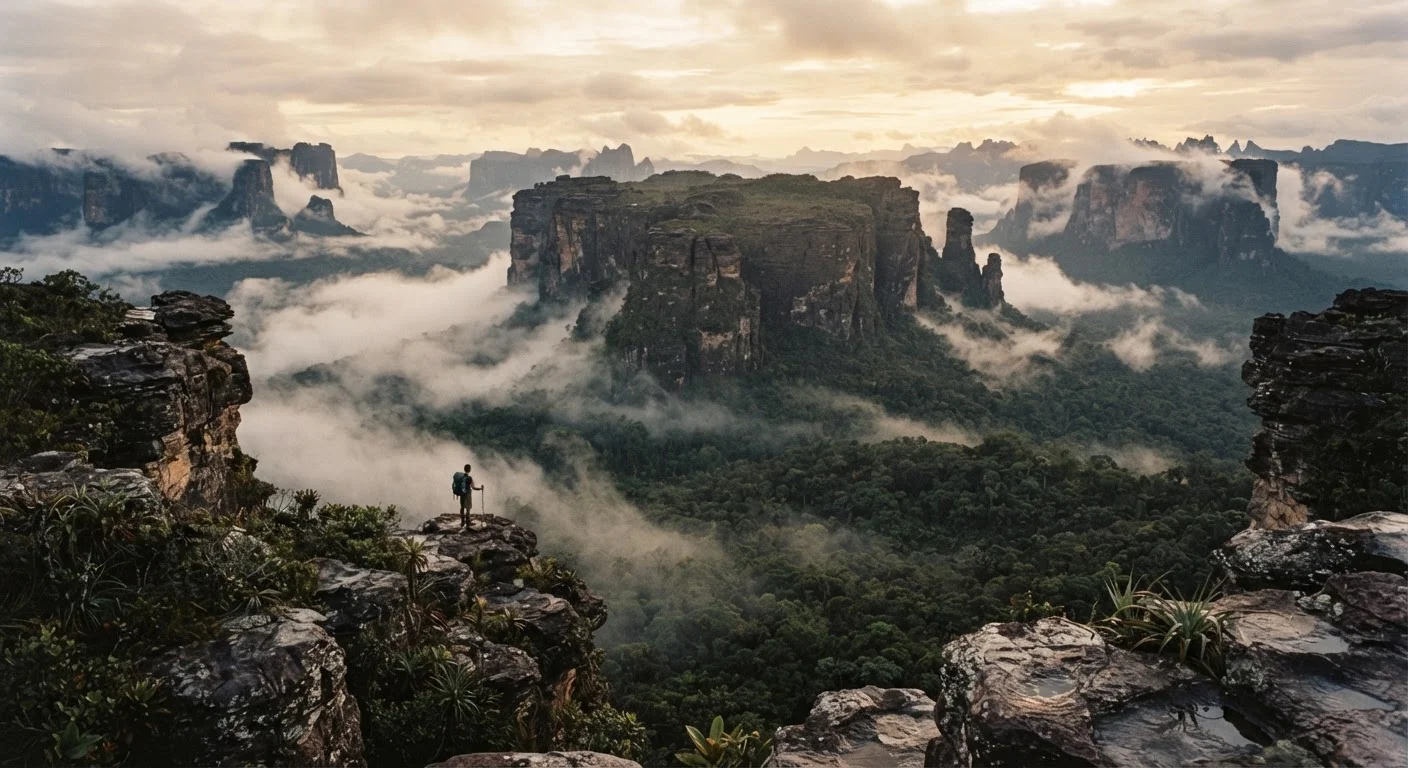
Photo credit: ExploreRoute.net | Travel Made Simple
In this article
From subterranean rivers to forgotten plateaus, explore natural wonders that remain largely unknown even to seasoned adventurers.
Key Takeaways
- Several remarkable wilderness areas remain largely absent from mainstream travel resources and popular trail databases.
- Geographic isolation, political boundaries, and limited infrastructure are the primary reasons these places stay uncrowded.
- Visiting remote natural sites responsibly requires verifying entry requirements and safety conditions with official sources beforehand.
- Indigenous communities often hold the deepest knowledge of these landscapes — engage respectfully and with permission.
- Satellite imagery and topographic maps can help experienced travelers begin researching genuinely off-grid terrain.
The Wilderness the Maps Left Behind
Every seasoned traveler reaches a moment when the well-worn routes stop feeling like discovery. The famous gorges have trail apps. The celebrated fjords have cruise ships. And yet, scattered across every continent, there are landscapes so remote, so structurally difficult to access, or so deliberately overlooked by the travel industry that they persist in genuine obscurity — not as myths, but as real, visitable places that reward the determined and the prepared.
What separates these sites from merely remote destinations is worth understanding before you go. As our exploration of what keeps natural wonders truly secret explains, geography, access infrastructure, and cultural context all play roles in keeping a place unknown. The wilderness areas below share one quality: they rarely appear in mainstream travel media, and that silence is largely what protects them.
These Places Aren't Unoccupied
The wilderness areas listed here are not empty. They are home to pastoralist communities, Indigenous peoples, and wildlife populations whose presence long predates any recreational travel interest. Responsible visitors research local customs, seek appropriate permissions, and engage with local guides rather than attempting independent access in unfamiliar terrain. The goal is to be a respectful guest, not an explorer claiming discovery.
Before you explore any of these destinations, it's worth remembering that truly remote doesn't mean truly untouched. As discussed in our piece on why 'undiscovered' wilderness is never truly undiscovered, Indigenous peoples and local communities have known and cared for these landscapes for generations. Responsible travel means approaching with humility.
Seven Wilderness Areas Hiding in Plain Sight
The Selous-Niassa Corridor, Tanzania and Mozambique
Spanning roughly 130,000 square kilometers across two countries, the Selous-Niassa wildlife corridor is one of the largest unfenced ecosystems remaining in Africa. While the Selous Game Reserve itself carries some name recognition, the vast miombo woodland stretching south into Mozambique's Niassa Reserve is virtually absent from Western travel narratives. Elephant herds, wild dog packs, and sable antelope move through landscapes that see almost no recreational visitors. Road access is seasonal at best, and crossing the international boundary requires careful advance planning — but for those who arrive, the silence is profound and the wildlife density extraordinary.
One of Africa's largest unfenced ecosystems, and one of its least-visited by international travelers.
The Wakhan Corridor, Afghanistan and Tajikistan
Pressed between the Hindu Kush, the Pamir mountains, and the borders of China and Pakistan, the Wakhan Corridor is a narrow finger of high-altitude wilderness where the Silk Road once threaded through passes above 4,000 meters. The Tajik side — accessible through Murghab — remains one of the few genuinely reachable sections for adventure travelers under current conditions. Here, yak caravans still cross boulder-strewn river valleys, and the sky at night has no competing light source for hundreds of kilometers. Travel conditions and advisories for this region change frequently; consult your government's official travel advisory service before any planning.
High-altitude Silk Road wilderness where yak caravans still cross passes above 4,000 meters.
Roraima Tepui Backcountry, Venezuela and Guyana
Mount Roraima's flat summit has entered the adventure travel lexicon, but the surrounding tepui (table-mountain) backcountry — particularly along the Guyanese and Venezuelan border ranges — remains almost entirely undocumented in English-language travel media. These ancient sandstone formations, dating back nearly two billion years according to geological records, host endemic species found nowhere else on Earth. The rock formations themselves are a geological record worth studying — a theme explored further in our guide to reading rock formations in wild landscapes. Access requires expedition-level preparation and local guide partnerships.
Sandstone formations nearly two billion years old, with endemic species found nowhere else on Earth.
The Fann Mountains, Tajikistan
Wedged between the better-known Pamir Highway and the ancient cities of Samarkand and Bukhara, the Fann Mountains offer a concentration of turquoise glacial lakes, soaring granite peaks, and shepherd trails that almost no international trekking itinerary includes. Villages like Artuch serve as quiet base points for multi-day routes where encounters with other foreign hikers are genuinely rare. The lakes — Alaudin, Kulikalon, and Iskanderkul among them — carry colors that seem implausible without the context of suspended glacial minerals. Infrastructure is minimal; self-sufficiency is essential.
Turquoise glacial lakes and granite peaks on routes where encountering other foreign hikers is genuinely rare.
The Cockscomb Basin Interior, Belize
Most visitors to Cockscomb Basin Wildlife Sanctuary — established in 1986 as the world's first jaguar preserve — stick to the accessible trail network near the main entrance. The interior of the basin, however, is dense primary rainforest that receives almost no foot traffic. Subterranean river systems carve through karst limestone beneath the forest floor, creating the kind of hydrological complexity that shapes unique ecosystems above and below ground. For travelers drawn to the intersection of water and hidden landscape, this connects thematically to the submerged worlds explored by divers and historians — though here the rivers run wild rather than through drowned towns. Entry to restricted zones requires sanctuary permits.
Dense primary rainforest with subterranean rivers flowing through karst limestone beneath the forest floor.
The Ennedi Plateau, Chad
In the northeastern corner of Chad, the Ennedi Massif rises from the Sahara in sandstone arches, canyons, and sheltered pools called guelta — permanent water sources that sustain desert crocodiles, migratory birds, and Toubou pastoralists in one of the most arid regions on the planet. Rock art sites here, some estimated to be thousands of years old, document a Saharan past when the region held grasslands and rivers. UNESCO recognized Ennedi's outstanding universal value in 2016, yet organized tourism remains extremely limited and logistically complex. Travelers considering this destination should consult current travel advisories carefully, as regional security conditions across the Sahel fluctuate.
Sandstone canyons sheltering desert crocodiles and thousands-of-years-old rock art in the Sahara.
The Interior Ranges of the Tian Shan, Kyrgyzstan
While the Central Tian Shan around Khan Tengri has attracted serious mountaineers for decades, the rolling inner ranges of Kyrgyzstan — particularly the At-Bashy and Torugart regions — offer vast high-altitude steppe, glacial river valleys, and yurt-dwelling communities that see almost no recreational travel. Horses remain the primary means of navigating terrain where roads give out entirely, and the scale of open space is disorienting in the best possible way. The logic of hidden scenic drives applies here in a different register: the journey between valleys is itself the destination. Permit requirements exist for some border-adjacent zones; verify before departure.
High-altitude steppe and glacial valleys where horses are the only reliable way to navigate the terrain.
Research Before You Rely on Any Map
Topographic data for many of these regions is incomplete, outdated, or deliberately restricted. Before planning any expedition, cross-reference multiple sources: official national park or protected area authorities, your government's travel advisory service, and if possible, academic or conservation organizations active in the region. Satellite imagery platforms can supplement paper maps but should not be treated as a substitute for on-the-ground local knowledge.
Once you've identified a destination, preparation becomes everything. If maps and travel blogs fall short, our guide on planning a trip to a remote natural site you can't find on Google walks through research methods, safety protocols, and how to reach places with little public documentation. Topo lines and satellite imagery can also signal remarkable terrain before you ever set foot on a trail — a skill detailed in our guide to reading geographic clues in the landscape.
Going Without a Map — But Not Without a Plan
The appeal of unmapped wilderness is real, but so are the risks. Remote natural sites often lack search-and-rescue infrastructure, reliable communications, and marked trails. Entry requirements — including permits, visa conditions, and protected area regulations — vary enormously and can change without notice. Always verify current conditions, entry rules, and safety advisories with official government sources and, where applicable, with park or land management authorities before travel.
If the prospect of blank spaces on the map appeals to you beyond these seven sites, our overview of eight overlooked regions that reward the truly curious traveler covers a broader geographic range of genuinely wild terrain. And for travelers drawn as much to human history as to raw landscape, the hidden world of forgotten historic sites offers another kind of discovery entirely — one where wilderness and civilization blur at the edges of memory.
The world is not running out of extraordinary places. It is running out of travelers willing to look beyond the obvious ones.

Author
Hidden Destinations Editorial Team
Hidden Destinations Editorial Team is the collective byline for our editorial team and contributor network. Articles published under this byline or an editorial pen name are researched, written, and reviewed according to our editorial standards for clarity, consistency, and independence before publication.
View all articles →