
The Loneliest Roads in the American West Worth Seeking Out
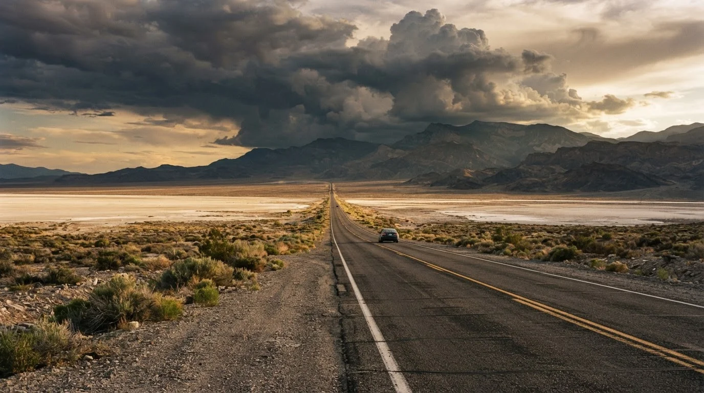
Photo credit: ExploreRoute.net | Travel Made Simple
In this article
From Nevada's Basin and Range to Oregon's outback, these desolate western drives reward patience with staggering, crowd-free scenery.
Key Takeaways
- Nevada's US-50 and Oregon's Outback Highway offer hundreds of miles of driving with minimal traffic and no tourist crowds.
- Fuel, water, and cell service are scarce on these routes — preparation is non-negotiable before departure.
- The rewards include ancient petroglyphs, volcanic formations, ghost towns, and wildlife rarely seen from busier roads.
- Seasonal timing matters: summer heat in Nevada basins and winter snow on high-elevation Oregon routes can make conditions dangerous.
- These drives complement, rather than replace, national park itineraries — they reveal the vast wild country in between.
Why the Loneliest Roads Deserve a Place on Your Map
The American West is enormous in ways that maps don't quite convey. National parks draw millions of visitors each year, funneling crowds through a handful of famous viewpoints. But between those landmarks lies something just as spectacular and far less trampled: open highways crossing basin and range country where you might drive two hours without seeing another car.
These aren't roads for everyone. They demand preparation, patience, and a certain comfort with vastness. But for travelers willing to plan carefully, they deliver an experience that no overlook platform or park shuttle can replicate. For broader context on researching and planning this kind of trip, see our complete guide to discovering hidden scenic drives.
US Route 50 Through Nevada — The Loneliest Road in America
The federal government once called US-50 across Nevada too desolate to travel safely. The state turned that slight into a marketing slogan, and the road delivered on both counts. Stretching roughly 410 miles from Ely to Fernley, the highway crosses seven mountain ranges and five valleys, passing through tiny communities like Austin, Eureka, and Fallon — each with a story embedded in silver mining history.
The landscape alternates between salt flats, sagebrush valleys, and pinyon-juniper ridgelines with almost hypnotic regularity. The Pony Express Trail ran through much of this same corridor, and interpretive markers along the route connect you to that history. Gas up religiously at every town; the gaps between services are real.
Seven mountain ranges, five valleys, and almost no traffic — US-50 across Nevada earns every word of its nickname.
Oregon Outback Highway (OR-31 and OR-395 Corridor)
Oregon is famous for its coast and its Cascades. Far fewer travelers push southeast into the state's high desert outback, where juniper flats and alkali lakes stretch toward the Nevada border with almost no development in sight. The stretch along OR-31 through the Summer Lake basin and down toward Lakeview — then north again on OR-395 — traces a loop through country that feels genuinely remote even by western standards.
Summer Lake Hot Springs, the Albert Rim (one of North America's longest exposed fault scarps), and the Hart Mountain National Antelope Refuge all sit within range of this corridor. Pronghorn antelope are a common roadside sight. The broader region rewards curious travelers willing to move slowly.
Oregon's high desert outback is where the state's wild heart beats quietly — and almost entirely without crowds.
Nevada State Route 375 — The Extraterrestrial Highway
Running 98 miles through Lincoln County, NV-375 is technically famous — officially designated the Extraterrestrial Highway in the 1990s — but remains extraordinarily empty in practice. The proximity to the Nevada Test and Training Range generates the cultural mythology; the landscape generates the actual awe. Broad valleys rimmed by treeless ranges, cloud shadows moving across pale hardpan, and a sky so dark after sunset that the Milky Way appears almost tactile.
Rachel, the only community on the route, has a small diner and not much else. That's the point. The road connects US-93 near Ash Springs to US-6 near Warm Springs, making it a genuine through-route rather than a dead-end detour.
NV-375 is nominally famous but practically empty — a wide-open corridor through some of Nevada's most dramatic basin country.
Idaho's Owyhee Uplands Backcountry Byway
The Owyhee Plateau in southwestern Idaho is one of the least-visited landscapes in the contiguous United States. The Owyhee Uplands Backcountry Byway — which requires a high-clearance vehicle for portions — crosses deeply eroded canyon country colored in rust, ochre, and charcoal. The Owyhee River cuts through this terrain in gorges that rival anything more famous, and the birding (raptors especially) is exceptional.
This route demands more vehicle preparation than paved alternatives. Confirm current conditions with the Bureau of Land Management before attempting it, particularly after winter or during wet spring conditions. The reward is landscape that genuinely few people ever see.
Idaho's Owyhee canyonlands rival more famous western gorges — and almost nobody goes there.
New Mexico's NM-53 and El Malpais Loop
West of Albuquerque, the country opens into a volcanic plateau where lava flows as recent (in geological terms) as 3,000 years ago sit alongside ancient Puebloan ruins and towering sandstone bluffs. NM-53 loops south from Grants through the El Malpais National Monument area and back north via NM-117, traversing a landscape of extraordinary geological variety in under 100 miles.
Bandera Volcano, the Zuni-Acoma Trail, and the La Ventana Natural Arch anchor the route with specific destinations, but the drive between them is the experience. This pairs naturally with desert drives that venture beyond park boundaries for a broader New Mexico itinerary.
NM-53 through El Malpais loops through lava fields, ancient ruins, and sandstone arches in under 100 miles of pavement.
US Route 93 Through Central Nevada — Lonelier Than It Looks
US-93 runs north-south through Nevada's interior, connecting Las Vegas to the Idaho border. Most drivers treat it as a through corridor, barely pausing. That's an error. The stretch between Ely and Wells passes through the Steptoe Valley and skirts the Ruby Mountains — a range so scenic and so overlooked that locals call it the Alps of Nevada — with minimal traffic and no entrance fees.
The Rubies offer hiking trails, glacier-carved lakes, and camping at Lamoille Canyon that rival anything in the Sierra Nevada for scenery. The road itself is smooth and well-maintained; the emptiness comes from low awareness, not difficulty. This is part of the broader fabric of iconic western routes that reward travelers willing to look past the obvious.
The Ruby Mountains rise along US-93 in central Nevada — glacier-carved and stunning, yet barely known outside the state.
Before You Go: A Few Honest Realities
Isolation is the appeal here, but it's also the risk. On several of these routes, the next service station may be 80 to 120 miles away. Cell coverage disappears for long stretches. Always carry more fuel than you think you need, at least a gallon of water per person per day in summer, and a physical map or downloaded offline route — do not rely on live navigation.
Fuel and Water: The Non-Negotiable Rule
On any of these routes, treat every fuel stop as mandatory — even if your gauge reads half full. Carry at least one gallon of drinking water per person per day during warmer months, and consider a two-gallon buffer for vehicle cooling emergencies. A paper map or pre-downloaded offline route file should back up any digital navigation, since cell service can vanish for 50-plus miles at a stretch.
If you're drawn to the desert landscapes specifically, our desert drives beyond the national parks piece covers terrain that pairs naturally with many routes listed here. And if you want to trade basin floors for grassland horizons, the Great Plains have their own underrated drives that reward exactly the same kind of unhurried curiosity.
Check current road conditions with state DOT resources before departure, and always let someone know your planned route and expected check-in times. Solitude is earned, not guaranteed — plan like it matters.

Author
Road Trip Culture Editorial Team
Road Trip Culture Editorial Team is the collective byline for our editorial team and contributor network. Articles published under this byline or an editorial pen name are researched, written, and reviewed according to our editorial standards for clarity, consistency, and independence before publication.
View all articles →