
Your First Multi-Day Wilderness Trek: Reading the Terrain Before You Go
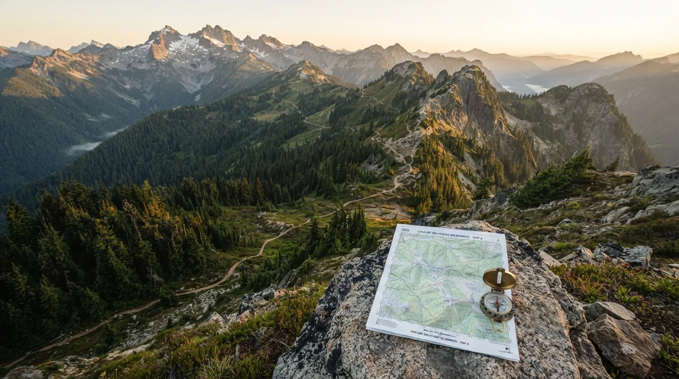
Photo credit: ExploreRoute.net | Travel Made Simple
In this article
Heading into the backcountry for the first time? Learn how to read maps, assess trail difficulty, and plan a safe multi-day wilderness trek.
Key Takeaways
- Topographic maps reveal elevation gain, drainage patterns, and exposed ridgelines that trip reports often omit.
- Trail difficulty ratings vary by system and rarely account for conditions like snow, mud, or river crossings.
- Environmental hazards — flash flood zones, avalanche paths, exposed traverses — must be identified before departure.
- A realistic daily mileage plan accounts for elevation change, not just flat distance.
- Always verify entry requirements, permits, and safety conditions with land management agencies before travel.
Why Terrain Reading Matters Before You Step Off the Trailhead
Most backcountry incidents don't begin on the trail — they begin at the planning stage, when hikers underestimate what the landscape will actually demand. A multi-day wilderness trek introduces variables that day hikes rarely surface: sustained elevation change, remote water sources, weather windows, and terrain that looks manageable on a screen but is punishing underfoot.
The skill of reading terrain before you go isn't about being cautious — it's about being prepared to make good decisions throughout the trip. For a deeper orientation to backcountry travel as a whole, see our beginner's guide to remote wilderness travel, which covers navigation basics and leave-no-trace principles alongside terrain awareness.
Terrain reading bridges the gap between what a trail listing tells you and what the land will actually ask of you.
Contour lines
Lines on a topographic map that connect points of equal elevation, allowing you to visualize hills, valleys, and slopes before you arrive.
Cumulative elevation gain
The total amount of uphill climbing over an entire route, regardless of the starting and ending altitude. This is often more relevant to effort than the highest point reached.
Watershed
All the land that drains into a common river, stream, or lake. Understanding the watershed above your route helps you anticipate flash flood risk and water availability.
Talus
Loose, angular rocks that have broken off from cliffs and accumulated on slopes. Talus terrain is slower and more demanding to cross than maintained trail surfaces.
Land management agency
A government body responsible for overseeing public land — such as the US Forest Service or National Park Service — that sets permit requirements and provides current trail conditions.
Trip plan
A written document left with a trusted contact that details your route, expected campsites, and return date, used by search and rescue teams if you don't return as planned.
Decoding Topographic Maps
A topographic map (commonly called a topo map) compresses the three-dimensional landscape into a two-dimensional sheet using contour lines. Each line represents a consistent elevation interval — typically 40 or 80 feet in USGS 7.5-minute series maps. The closer the lines, the steeper the slope.
Beyond slope, topo maps communicate drainage patterns. V-shaped contour formations pointing uphill indicate valleys or stream channels — critical information for planning water resupply and anticipating flood risk. U-shapes pointing downhill indicate ridgelines. Recognizing these patterns lets you mentally walk the route before you physically do.
When researching routes in areas with limited public documentation, the strategies outlined in planning a trip to a remote natural site can help you source reliable map data when standard travel resources fall short.
Use Multiple Map Scales Together
Download both a large-scale overview map (1:100,000 or similar) and a detailed 1:24,000 USGS topo for your specific route. The overview shows the broader landscape and access context; the detailed map reveals individual drainage crossings and micro-terrain. Cross-referencing both prevents the tunnel vision that comes from planning on a single scale.
Assessing Trail Difficulty: What the Numbers Don't Tell You
Official trail difficulty ratings — easy, moderate, strenuous — are inconsistently applied across land management agencies and rarely account for current conditions. A moderate trail at low elevation in summer may be a technical challenge with late-season snowpack. What ratings reliably communicate is relative difficulty within a specific system, not universal effort required.
A more useful framework considers three components independently: total distance, cumulative elevation gain, and terrain type. A 15-mile route with 4,000 feet of gain over talus and scree demands a fundamentally different level of fitness and footwear than 15 miles across a flat river valley. Separate each variable and assess them on their own terms.
Trip reports, ranger station condition updates, and recent visitor entries in trail registers provide ground-truth information that ratings cannot. Approach these sources critically — conditions shift week to week, and individual fitness levels vary widely among report authors.
Difficulty Ratings Are Not Universal
A trail rated 'moderate' by one agency may be rated 'strenuous' by another using the same terrain. Never rely on a single rating to assess a route's demands. Always decompose the route into its distance, elevation gain, and terrain type, and check recent condition reports from the relevant ranger district before committing to an itinerary.
Environmental Hazards to Identify During Planning
Terrain analysis is inseparable from hazard identification. Several categories of risk can be spotted on a map and researched in advance:
- Flash flood zones: Slot canyons, dry washes, and narrow valley bottoms are high-risk during or after rain events, even storms miles away. Check the topography of the entire watershed above your route, not just the immediate trail corridor.
- Exposed ridgelines: Long ridgeline traverses above treeline create lightning exposure and wind vulnerability. Identify these segments and plan to cross them during morning hours when afternoon storms are less likely at altitude.
- River crossings: Unbridged crossings that appear minor on a map can become dangerous with snowmelt or rain. Research crossing points carefully — our companion guide on managing wilderness risk covers how to assess and safely approach these decisions.
Verify current hazard conditions with the relevant ranger district before departure. Always review official travel advisories through agency websites before finalizing any backcountry itinerary.
Building a Realistic Daily Mileage Plan
Flat mileage is a misleading metric in wilderness planning. A standard method used by many experienced trekkers is Naismith's Rule: allow one hour for every 3 miles of distance plus an additional hour for every 2,000 feet of ascent. This produces a rough time estimate that you can then calibrate to your own fitness level during shorter training hikes before the main trip.
Build buffer into every multi-day plan. Weather delays, slower-than-expected terrain, or a minor injury can compress your available window significantly. Plan rest days or shorter mileage days at intervals — not as indulgences, but as structural risk management.
Before finalizing your route, cross-reference it against a thorough pre-departure checklist. Our pre-trip checklist for unmarked natural areas applies directly to any remote wilderness itinerary, covering everything from gear verification to communication protocols.
Permits and Entry Requirements Vary Widely
Many popular wilderness areas in the US require overnight backcountry permits that must be obtained weeks or months in advance. Quota systems apply to some of the most visited zones during peak season. Contact the administering ranger station or visit the official agency website well ahead of your planned travel dates to understand current requirements.
This article provides general educational information about wilderness trek planning. Always consult official land management agencies, qualified guides, and emergency services resources before undertaking backcountry travel. Conditions in wilderness areas can change rapidly; no planning resource substitutes for current, on-the-ground information from authoritative sources.
Frequently Asked Questions

Author
Specialty Travel Editorial Team
Specialty Travel Editorial Team is the collective byline for our editorial team and contributor network. Articles published under this byline or an editorial pen name are researched, written, and reviewed according to our editorial standards for clarity, consistency, and independence before publication.
View all articles →