
Driving Through National Forests: What Sets These Roads Apart from Parkways
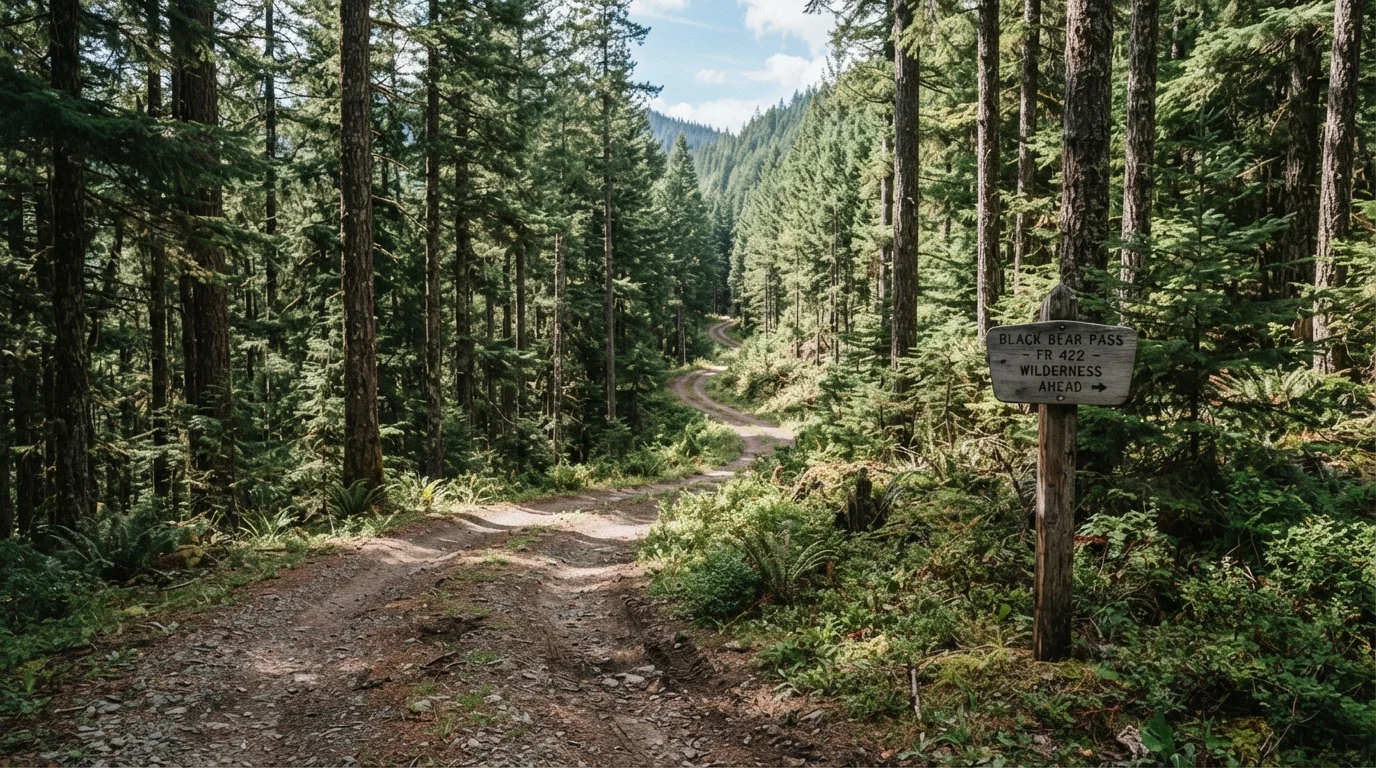
Photo credit: ExploreRoute.net | Travel Made Simple
In this article
National forest roads are rugged, remote, and often stunning — but they come with different rules and conditions than paved parkways.
Key Takeaways
- National forest roads are managed by the USDA Forest Service, not the National Park Service, and operate under different rules.
- Parkways like the Blue Ridge are paved, speed-controlled, and maintained for year-round passenger vehicle access.
- Many national forest roads require high-clearance or 4WD vehicles and may be impassable in wet or winter conditions.
- Forest roads typically have no entrance fees but also offer far less infrastructure — no guardrails, limited signage, no fuel.
- Both road types offer stunning scenery; the right choice depends on your vehicle, skill level, and appetite for solitude.
Two Systems, Two Philosophies
America's scenic driving network splits into two very different worlds. Parkways — think the Blue Ridge or Natchez Trace — were designed as recreational corridors: engineered, landscaped, and managed specifically so that the drive itself is the attraction. National forest roads, by contrast, exist primarily to provide access to working forest lands for logging, fire management, and recreation. Scenery is often spectacular, but it's incidental to the road's original purpose.
This distinction matters enormously in practice. The USDA Forest Service maintains roughly 370,000 miles of roads across 154 national forests. The quality, condition, and accessibility of those roads varies wildly — from smooth graded gravel suitable for most sedans to deeply rutted two-tracks that will swallow an unprepared vehicle whole. If you've spent time on the Blue Ridge Parkway, the contrast will be immediate and stark.
Road Surface, Speed, and Conditions
Parkways are paved, speed-controlled (usually 45 mph or under), and maintained to a consistent standard. Seasonal closures happen — ice and fog can shut sections — but the underlying infrastructure is purpose-built for visitor access. Both the Blue Ridge Parkway and Skyline Drive share this managed-corridor philosophy, even where their scenery diverges.
National forest roads are classified by a system ranging from Maintenance Level 1 (native surface, minimal maintenance, high-clearance required) to Level 5 (paved, suitable for passenger vehicles). Most roads open to the public fall between Levels 2 and 4 — meaning gravel or dirt surfaces, seasonal closures, and the real possibility of washouts after heavy rain. Cell service is frequently nonexistent. Always check current road conditions with the relevant ranger district before heading out, and read up on common misconceptions about remote terrain driving before you go.
| National Forest Roads | Scenic Parkways | |
|---|---|---|
| Surface | Gravel, dirt, or native surface (varies) | Paved, consistently maintained |
| Vehicle requirement | Often high-clearance or 4WD | Standard passenger vehicles |
| Infrastructure | Minimal — few signs, no guardrails, no fuel | Overlooks, visitor centers, emergency pull-offs |
| Entrance fee | Usually free; some trailhead fees | Free (Blue Ridge) or nominal fee |
| Camping | Dispersed camping generally permitted | Designated campgrounds only |
| Crowd level | Very low — often isolated | Moderate to high in peak season |
| Seasonal access | Often closed in winter; mud season risk | Partial closures; generally reliable |
Rules, Fees, and What You Can Do
Parkways typically prohibit commercial vehicles and enforce strict rules about where you can stop, camp, and recreate. National forests, on the other hand, allow dispersed camping on most forest land — no reservation, no fee, no designated site required, provided you follow Leave No Trace principles and any local fire restrictions. This freedom is one of the most compelling reasons to explore forest roads rather than sticking to managed corridors.
That said, some national forests do require a permit or day-use fee for certain trailheads and campgrounds. Rules vary significantly by forest and by season, so verify with the specific ranger district. For a broader grounding in how protected land access works, our complete guide to road tripping through national parks and reserves covers the regulatory landscape in useful depth.
Download Offline Maps Before You Go
Cell coverage on national forest roads is often nonexistent, and paper maps for specific forests can be difficult to find on the road. Download a detailed offline map — apps like Gaia GPS support USFS road layers — before leaving town. It's also worth downloading the specific motor vehicle use map (MVUM) for the forest you're visiting, which shows which roads are legally open to wheeled vehicles.
Scenery, Solitude, and the Case for Going Off-Grid
Parkways curate their views — overlooks are engineered, vegetation is managed, and the experience is reliably photogenic. National forest roads offer something harder to frame but arguably more affecting: a landscape you share with almost no one. These are the drives where you might spend four hours without seeing another vehicle, where the road crests a ridge to reveal an unplanned panorama that doesn't appear in any travel magazine.
The appeal is similar to what draws drivers to America's blue highways — an unmediated encounter with the land rather than a curated experience of it. The Ouachita National Forest in Arkansas, the Uinta-Wasatch-Cache in Utah, and the Shoshone in Wyoming all contain forest roads that could anchor a memorable multi-day trip, particularly for those who've already exhausted the obvious park circuits. If desert terrain interests you, remote desert drives beyond park boundaries extend the same off-grid logic into the Southwest.
370,000
Miles of USFS-managed roads nationwide
The USDA Forest Service maintains approximately 370,000 miles of roads across 154 national forests — more than the entire interstate highway system.
154
National forests in the United States
These forests span 44 states and Puerto Rico, covering roughly 193 million acres of public land managed by the USDA Forest Service.

Author
Road Trip Culture Editorial Team
Road Trip Culture Editorial Team is the collective byline for our editorial team and contributor network. Articles published under this byline or an editorial pen name are researched, written, and reviewed according to our editorial standards for clarity, consistency, and independence before publication.
View all articles →