
Reading the Roadside: How Landmarks, Signage, and Architecture Tell America's Story
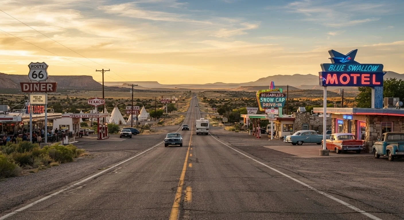
Photo credit: ExploreRoute.net | Travel Made Simple
In this article
Diners, motor courts, mission markers, and milepost signs — iconic routes are archives of American life if you know what to look for.
Key Takeaways
- Roadside architecture, signage, and landmarks function as a physical timeline of American economic and social history.
- Understanding what to look for — vernacular buildings, highway markers, commercial strips — transforms driving into active cultural reading.
- Slowing down and stopping at overlooked structures often reveals more than designated tourist sites.
- Cross-referencing what you see with historical maps and local archives deepens the story behind any route.
- The built environment along iconic roads reflects migration patterns, booms, busts, and evolving American identity.
The Road as Archive
Most drivers treat the highway as a corridor — a means of getting somewhere else. But if you shift your frame slightly, every mile becomes a document. The roadside is one of America's most honest museums: unedited, weathered, and still largely free to read from behind the wheel.
Classic American driving routes — Route 66, the Lincoln Highway, the old US byways that predate the interstate system — accumulated their character across decades of commercial energy, migration waves, and civic ambition. The structures, signs, and landmarks that survive along them aren't accidental. They were built to serve specific travelers at specific moments in American life, and they carry that context in their bones.
Learning to read that context makes any drive richer. It also makes stops more intentional — you start pulling over for reasons, not just impulses.
Best Practices for Reading Roadside History
These approaches will help you move from passive observer to active reader of the American roadside landscape.
Research the era of construction before driving a route segment.
Knowing when a road was built — or when it was at its commercial peak — gives you the right frame for interpreting what you see. A 1930s-era stretch will show Depression-era resourcefulness; a 1950s suburban corridor reflects postwar consumer expansion. Without that context, a weathered motel is just a weathered motel.
Cross-reference what you see with historic Sanborn fire insurance maps.
Sanborn maps, produced for fire insurance purposes from the late 19th century through the mid-20th, documented building footprints and materials in extraordinary detail. Comparing a historic Sanborn map to a modern satellite view reveals what was demolished, what survived, and what replaced it — a visible palimpsest of a town's economic history.
Slow down through commercial strips rather than bypassing them.
The commercial strip — gas stations, motels, diners, drive-ins — is often dismissed as visual clutter. But it's one of the most concentrated expressions of American vernacular commercial architecture, and it changes meaningfully from region to region and decade to decade. The strip encodes local economy, dominant industries, and traveler expectations of each era.
Use topography and land use patterns to infer settlement history.
Towns aren't placed randomly. They cluster at river crossings, railroad junctions, natural springs, and defensible heights. Understanding why a town exists where it does tells you what drove settlement — and explains the architectural character that followed. Hidden scenic drives often pass through landscapes where this settlement logic is still clearly legible.
Photograph and document what you find, with location data.
Roadside structures deteriorate rapidly, and many are lost between visits. Documenting what you encounter — with approximate locations and observations about condition — contributes to a broader collective record. Organizations like the Historic American Buildings Survey and state preservation offices actively use crowdsourced documentation.
Read roadside absence as carefully as presence.
Gaps in the built environment — empty lots, scorched foundations, overgrown driveways — are as historically meaningful as standing structures. They mark demolition, fire, economic collapse, or highway realignment. A town with a wide main street and mostly empty lots was once far more prosperous; the scale of the street is the fossil record of that prosperity.
Quick Wins Before You Leave the Driveway
You don't need a history degree to read the road well. A few minutes of preparation before any trip can sharpen your eye considerably. See our preparation checklist for the full pre-drive rundown.
For a deeper understanding of what the terrain itself is communicating — geology, agriculture, ecology — pair these practices with the landscape reading guide for scenic drives.
Architecture Styles as Historical Timestamps
Every building style along a classic route corresponds to an economic era. Streamline Moderne diners signal the optimism of the late 1930s and postwar prosperity. Googie architecture — the swooping rooflines and boomerang shapes of coffee shops and motels from the 1950s and 60s — reflected the Space Age excitement of car culture at its peak. Spanish Colonial Revival missions and their descendants mark the older corridors of the Southwest, where 18th-century settlement patterns still shape town layouts.
Vernacular Architecture: A Quick Definition
Vernacular architecture refers to structures built without a professional architect, using local materials and regional traditions — the roadside diner, the cinder-block filling station, the hand-lettered tourist cabin sign. These buildings rarely appear in design histories, but they're the most authentic record of how ordinary Americans built and traveled. Preservation organizations like the Vernacular Architecture Forum actively document these structures before they disappear.
Motor courts — those single-story clusters of individual cabins arranged in a U around a parking court — represent the first generation of American roadside hospitality, built before corporate chains standardized the experience. When you spot one still operating, or even standing abandoned, you're looking at the direct ancestor of every motel sign you've ever passed.
Blue highways — the old two-lanes that ran through town centers rather than around them — tend to preserve a higher density of these architectural layers, precisely because they were bypassed before demolition became profitable.
Signage, Mileposts, and the Language of Wayfinding
Highway signage has its own grammar, and reading it historically adds a layer of meaning to every drive. The shield-shaped US Route markers, standardized in 1926, were designed as a federal system to unify a patchwork of state roads — the number alone can tell you whether you're on a north-south or east-west corridor. The older the route number, the closer it runs to the original transcontinental concept of the US highway grid.
State historical markers — those cast-metal or painted signs planted along roadsides by historical commissions — are among the most underused resources on any drive. They're inconsistent in depth and sometimes dated in framing, but they reliably flag where something significant once happened: a battle, a settlement, a crossing point, a lost town. Treat them as entry points, not endpoints.
Tourist orientation signs — the brown-and-white federal standard — signal historic sites and landmarks that have earned some level of official recognition. But the structures without signage are often equally interesting. A building too modest for a marker may still be architecturally or socially significant; local preservation organizations and county historical societies frequently maintain records that fill these gaps.
For a full picture of how routes earn their iconic status, this guide to what makes a route iconic lays out the criteria clearly. And if you want to explore the national framework of protected scenic corridors, America's Scenic Byways reference guide maps the full designation system.
~16,000
Miles in the original US Highway System (1926)
The Federal Highway Administration designated approximately 16,000 miles of US routes when the numbered highway system was standardized in 1926, forming the backbone that roadside commercial America was built around.
Over 150,000
Recorded entries in HABS/HAER documentation
The Library of Congress's Historic American Buildings Survey and Historic American Engineering Record together hold documentation on more than 150,000 structures and sites across the United States, many of them along historic travel corridors.
When you step off the main route into small-town centers — and you should — the principles in reading a small town like a local apply directly. The courthouse square, the main-street commercial block, the water tower — they're all part of the same text the highway was writing.

Author
Road Trip Culture Editorial Team
Road Trip Culture Editorial Team is the collective byline for our editorial team and contributor network. Articles published under this byline or an editorial pen name are researched, written, and reviewed according to our editorial standards for clarity, consistency, and independence before publication.
View all articles →