
Route 66: The Road That Built America's Wandering Spirit
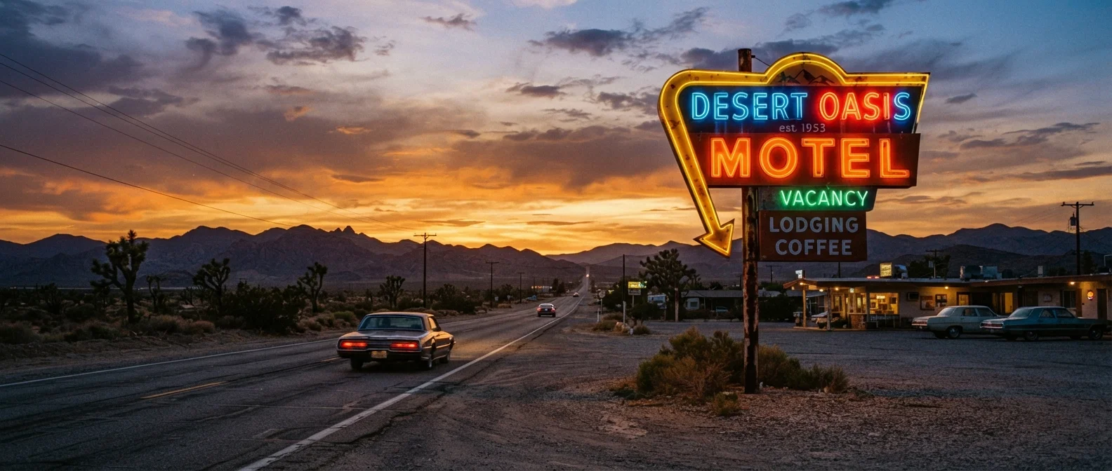
Photo credit: ExploreRoute.net | Travel Made Simple
In this article
Trace the history, iconic stops, and cultural legacy of Route 66, from Chicago's city streets to the sun-baked California coast.
Key Takeaways
- Route 66 spans approximately 2,400 miles across eight states from Chicago to Santa Monica.
- Officially decommissioned in 1985, large stretches remain driveable and are preserved as historic byways.
- The route passes through dramatically varied landscapes — prairies, deserts, canyons, and coastline.
- Roadside architecture, diners, and motor courts along the route are living archives of mid-century American life.
- Advance preparation — especially for remote desert stretches — is essential for a safe and rewarding journey.
The Birth of the Mother Road
Few corridors in American history carry the weight of Route 66. Established on November 11, 1926, by the U.S. Highway System, the road connected Chicago, Illinois to Santa Monica, California — threading together small towns, farming communities, and sun-baked frontier landscapes that had previously existed in near-isolation from one another.
The highway's nickname, the Mother Road, was coined by John Steinbeck in The Grapes of Wrath (1939), where it served as the desperate migration path for Dust Bowl families fleeing Oklahoma toward California's promise. That cultural imprint never faded. Route 66 became synonymous with American mobility itself — the idea that the open road could carry you toward something better.
Compared to America's first coast-to-coast road, which connected New York to San Francisco as early as 1913, Route 66 was younger but broader in its cultural reach — intersecting with jazz, postwar prosperity, and the birth of car culture in a way no other highway quite matched.
The Route Has Multiple Historical Alignments
Route 66 was realigned several times between 1926 and 1985, meaning there is no single 'original' path. In some areas, multiple historic alignments exist side by side. Enthusiast organizations like the U.S. Route 66 Association publish detailed alignment guides that help travelers choose between the earliest and later versions of the road.
Iconic Stops Along the Route
The road rewards curiosity. From Illinois to California, each state adds its own distinct character to the journey.
- Chicago, Illinois: The route technically begins at the intersection of Adams Street and Michigan Avenue, steps from Millennium Park.
- Cadillac Ranch, Texas: Ten Cadillacs buried nose-first in a Amarillo field — one of America's most photographed public art installations and a monument to the car's hold on the American imagination.
- Petrified Forest National Park, Arizona: Ancient fossilized logs and painted desert badlands straddling the old alignment of the highway.
- Wigwam Motel, Holbrook, Arizona: Concrete teepee-shaped rooms that exemplify the roadside novelty architecture that made Route 66 a visual spectacle.
- Santa Monica Pier, California: The western terminus — an end-of-road marker where the Pacific finally meets the pavement.
Roadside architecture tells America's story in ways that standard tourism rarely captures. The diners, motor courts, and neon signs along Route 66 are physical records of how the country ate, slept, and moved for decades.
2,400
Miles from Chicago to Santa Monica
Route 66 crosses eight states: Illinois, Missouri, Kansas, Oklahoma, Texas, New Mexico, Arizona, and California.
8
States crossed by the original alignment
Each state contributes distinct terrain, architecture, and cultural character to the overall journey.
1985
Year Route 66 was decommissioned
The U.S. Highway System officially removed Route 66 from its maps after the Interstate System made it redundant.
The Cultural Legacy of Route 66
Route 66 didn't just move people — it shaped identity. The postwar boom sent American families onto the highway in station wagons and sedans, stopping at drive-ins, souvenir shops, and roadside zoos. It made the road trip a rite of passage. Music, film, and literature absorbed its imagery until the highway became shorthand for freedom, restlessness, and reinvention.
Bobby Troup's 1946 song (Get Your Kicks on) Route 66 and the 1960s television series Route 66 cemented that image globally. Today, travelers from dozens of countries drive segments of it specifically to experience what they regard as quintessential America.
“Route 66 is the path of a people in flight, refugees from dust and shrinking land, from the thunder of tractors and shrinking ownership. 66 is the mother road, the road of flight.”
— John Steinbeck, Author of The Grapes of Wrath (1939)
Still, the road's cultural legacy is more complex than nostalgia allows. For many communities of color traveling during the Jim Crow era, Route 66 was not a freedom road — sundown towns and segregated facilities made travel dangerous and humiliating. Honest engagement with the route includes that history. For contrast, consider how different journeys shaped different Americas: the Oregon Trail route carries its own layered story of westward expansion and displacement.
Planning Your Drive: What to Know
Route 66 was officially decommissioned by the American Association of State Highway and Transportation Officials in 1985, replaced by the Interstate Highway System. However, most of its original alignment survives as state and local roads, historic byways, and frontage roads running alongside interstates.
Before you set out, check which segments are paved and passable — conditions vary by season and by state. Some stretches in New Mexico and Arizona are unpaved and require a vehicle with reasonable ground clearance. The road trip essentials hub is a solid starting point for vehicle prep, packing, and navigation strategy.
Best Seasons for the Full Route
Spring and fall offer the most reliable conditions across all eight states. Summer heat in the desert Southwest can exceed 110°F, which poses real risks to both drivers and vehicles. Plan desert segments — particularly Arizona and the Mojave — for early morning departures and midday rest stops.
Spring (April–May) and fall (September–October) offer the most comfortable driving conditions across the full route. Summer heat in Arizona and the Mojave Desert can be extreme, while winter brings road closures and ice in higher elevations. For a detailed prep framework, see our preparation checklist for iconic American routes before departure.
Also be aware: not every section has reliable cell service, and gas stations in remote stretches can be widely spaced. Offline maps and a full tank are non-negotiable in the desert Southwest.
Verify Road Conditions Before You Go
Original Route 66 alignments are maintained by individual states and counties, not the federal highway system, and conditions vary widely. Some unpaved sections are impassable after rain, and seasonal closures can affect mountain segments. Always check state DOT and county road condition resources before departure — do not rely solely on navigation apps, which may not reflect current closures.
Route 66 Beyond the Clichés
The postcard version of Route 66 — neon diners and cowboy kitsch — is real enough, but the road has more range than its greatest hits suggest. Small towns like Galena, Kansas and Tucumcari, New Mexico offer genuine community warmth, local art, and histories that most travelers blow past on the interstate. Slowing down is the point.
There's also more green on this route than most people expect. Plenty of Route 66 myths worth correcting persist — the idea that it's all desert, all the way. Illinois and Missouri deliver rolling farmland and river crossings; Oklahoma's green hills and redbud trees surprise drivers expecting scrubland.
If Route 66 feels too well-mapped for your taste, the hidden scenic drives collection covers backroads with far less foot traffic. And for a head-to-head comparison of two legendary American journeys, the Pacific Coast Highway vs. Route 66 breakdown lays out exactly what each offers. Route 66's power, though, is that it doesn't need to compete — it simply endures, mile by mile, as the road that taught America to wander.
Drive the route west-to-east at least once. Starting in Santa Monica and ending in Chicago puts the morning sun behind you for most desert stretches and lets you build into the landscape rather than away from it.
Sun angle affects both driving comfort and photography significantly over a multi-day journey, and eastbound driving is noticeably less fatiguing through the Mojave.
Carry a printed Thomas Guide or downloaded offline map for New Mexico and Arizona — cell coverage drops out entirely in stretches, and navigation apps can route you onto closed or impassable tracks.
Remote segments of the original alignment in the desert Southwest have limited or no cellular coverage, and several unpaved sections are not suitable for all vehicles.

Author
Road Trip Culture Editorial Team
Road Trip Culture Editorial Team is the collective byline for our editorial team and contributor network. Articles published under this byline or an editorial pen name are researched, written, and reviewed according to our editorial standards for clarity, consistency, and independence before publication.
View all articles →