
The Loneliest Road in America: Driving U.S. Route 50 Across Nevada
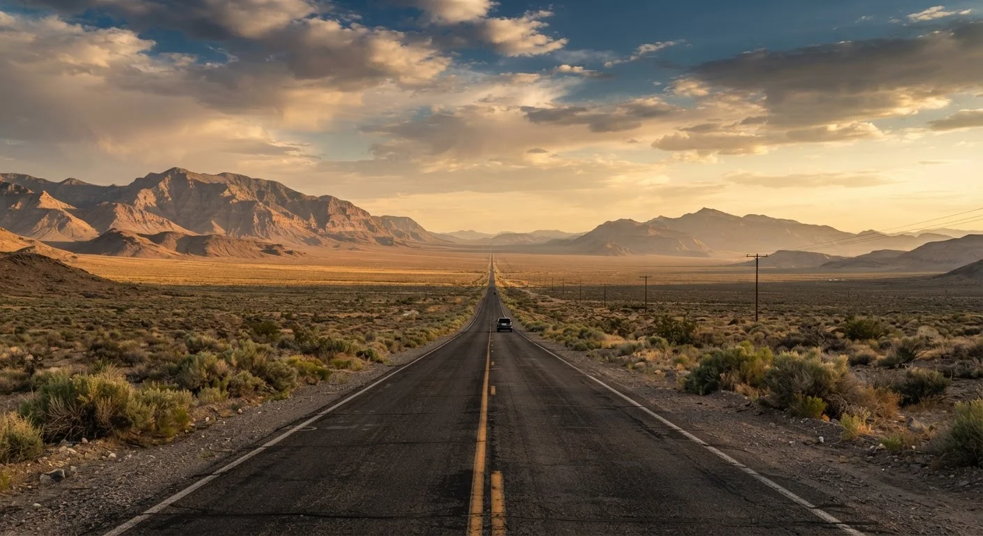
Photo credit: ExploreRoute.net | Travel Made Simple
In this article
Dubbed 'The Loneliest Road,' U.S. 50 crosses Nevada's empty basin-and-range landscape with a history stretching back to the Pony Express.
Key Takeaways
- U.S. Route 50 spans roughly 287 miles of Nevada desert between Ely and Fernley, passing through just a handful of small towns.
- The route follows corridors once used by the Pony Express, the Lincoln Highway, and overland emigrant wagon trains.
- Travelers should carry extra fuel, water, and supplies — gas stations can be 50+ miles apart.
- Five historic Nevada towns — Ely, Eureka, Austin, Fallon, and Fernley — anchor the route with museums, saloons, and stories.
- The drive rewards solitude seekers with ancient petroglyphs, dramatic passes, and virtually zero traffic.
Why They Call It the Loneliest Road
In 1986, Life magazine declared U.S. Route 50's Nevada stretch "the loneliest road in America," noting there was nothing along it and advising motorists not to attempt it without survival skills. Nevada's tourism officials did something clever: they leaned in. The state printed "U.S. 50 Survival Passports" and encouraged drivers to get them stamped in each town. The nickname stuck — and it isn't wrong.
Between Ely in the east and Fernley near the western edge, U.S. 50 crosses seven mountain ranges and six broad valleys with little separating them but sagebrush, sky, and silence. Traffic is genuinely sparse. Distances between services routinely exceed 50 miles. Cell coverage disappears for long stretches. For a certain kind of traveler, that's not a warning — it's the whole point.
If you've explored Route 66 and craved something wilder and emptier, U.S. 50 in Nevada delivers exactly that. It's part of the same great tradition of American driving, but stripped down to its most elemental form.
287 mi
Nevada stretch of U.S. Route 50
The highway spans from Ely to Fernley across central Nevada's basin-and-range terrain.
50+ mi
Typical gap between fuel stops
Several segments of the route have no services for 50 to 70 miles, making fuel planning essential.
18 months
Duration of the Pony Express
The Pony Express operated from April 1860 to October 1861 before the transcontinental telegraph replaced it.
6,600 ft
Elevation of Austin, Nevada
Austin sits high in the Toiyabe Range and is one of the more dramatically positioned towns on the route.
A Route Steeped in History
Long before it was a numbered highway, this corridor carried some of the most consequential traffic in American history. The Pony Express galloped through here beginning in 1860, with relay stations spaced roughly 10 miles apart across the same valley floors and mountain passes that U.S. 50 now traverses. Riders covered the 1,900-mile route between Missouri and California in about 10 days — an astonishing feat that lasted only 18 months before the transcontinental telegraph made it obsolete.
Before that, emigrant wagon trains bound for California during the Gold Rush crossed central Nevada on the Central Overland Route, pushing through these same desolate basins with far less certainty of what lay ahead. The historic Lincoln Highway — established in 1913 as America's first coast-to-coast road — also followed portions of this alignment, cementing the corridor's role as a transcontinental spine.
Driving U.S. 50 today, you're layering yourself atop riders, wagon trains, early motorists, and telegraph operators. The land hasn't changed much. That continuity is part of what makes the drive feel genuinely profound rather than merely scenic.
Pick up a free U.S. 50 Survival Passport at any chamber of commerce along the route and collect a stamp in each town — Nevada mails you a certificate and pin when you send in the completed booklet.
The passport program turns the drive into an achievable goal and ensures you actually stop and engage with each town rather than rolling through.
Drive west to east if your schedule is flexible — the morning light falls on the mountain ranges ahead of you rather than in your eyes, and the Ely end has the most lodging options for an easy first night.
Direction of travel is a small but meaningful variable on long desert drives where light conditions and end-of-day logistics both matter significantly.
Key Towns and Landmarks Along U.S. 50
Five towns punctuate the Nevada stretch of U.S. 50, each with its own distinct personality and a few must-stops worth slowing down for.
- Ely — The eastern gateway, Ely is larger than anything else on the route and home to the Nevada Northern Railway Museum, where you can ride a restored steam train through the surrounding copper country. The White Pine Public Museum is small but earnest in telling the region's mining history.
- Eureka — Once a roaring silver boomtown, Eureka preserves a remarkably intact 19th-century main street. The Eureka Opera House and Eureka County Courthouse are genuine architectural gems, not reconstructions.
- Austin — Perched at 6,600 feet in the Toiyabe Range, Austin's surviving buildings cling to a steep hillside. Stokes Castle, a three-story stone tower built in 1897, sits on the outskirts and is one of the more unusual structures in rural Nevada.
- Sand Mountain Recreation Area — Between Austin and Fallon, a massive dune field rises improbably from the flat desert floor. The dune reaches about 600 feet and is audible when the wind shifts sand — locals call it a "singing" dune.
- Fallon — The agricultural heart of the route, Fallon sits in the Lahontan Valley and serves as a practical resupply stop. The Churchill County Museum covers the region's Native American heritage and Pony Express history with genuine care.
Beyond towns, watch for the Hidden Cave Archaeological Site near Fallon — a location used by humans for roughly 8,000 years — and the petroglyphs at Grimes Point, just off the highway and free to visit.
Practical Planning for the Drive
U.S. 50's Nevada segment is not a route that forgives casual preparation. The distances are real, the heat can be extreme in summer, and the mountain passes carry snow well into spring. Treat logistics seriously and the drive becomes liberating rather than stressful.
Prepare Before You Leave Civilization
Cell service is intermittent to nonexistent across large portions of U.S. 50's Nevada stretch. Download offline maps before departing, carry a physical road atlas as backup, and let someone know your planned route and expected arrival times. In summer, a vehicle breakdown in direct sun can become a health emergency within hours — carry extra water, sun protection, and a basic emergency kit.
Fuel: Fill up at every town. The gap between Austin and Eureka is among the longest between services — roughly 70 miles — but conditions vary. Don't assume a station marked on an older map is still operating.
Water and food: Carry more than you think you need. A vehicle breakdown in midsummer in a Nevada basin is a genuine safety situation. A gallon of water per person per day is a reasonable baseline for desert travel.
Timing: Spring and fall offer the most comfortable driving temperatures. Summer midday heat in the valleys can exceed 100°F. Winter brings snow across the mountain passes; check road conditions through the Nevada Department of Transportation before traveling between November and March.
For those wanting to dig deeper into Nevada's other desolate corridors, the guide to the loneliest roads in the American West puts U.S. 50 in broader regional context.
The Character of the Road
What makes U.S. 50 different from a list of its stops and statistics is harder to quantify. The drive through Nevada's basin-and-range landscape follows a geological rhythm — valley floor, gradual climb, mountain pass, descent, repeat — that becomes almost meditative after the first few iterations. The mountains ahead are always visible long before you reach them. The ones behind stay in your mirror for what feels like hours.
There are no billboards. Radio stations come and go. Occasionally another vehicle appears in your rearview mirror and stays there, a distant companion, before eventually turning off. The experience is closer to the drives documented in this guide to hidden scenic drives than to any crowded heritage highway.
If you want a calibrated comparison, Pacific Coast Highway versus Route 66 covers two drives defined by spectacle and stop density. U.S. 50 in Nevada is their philosophical opposite — a route that asks you to bring your own entertainment, your own thoughts, and a full tank of gas.
Pick up that Survival Passport in Ely. Get every stamp. It takes about three days done comfortably, two if you push. Either way, you'll finish in Fernley with a quiet sense of having earned something most travelers never find.

Author
Road Trip Culture Editorial Team
Road Trip Culture Editorial Team is the collective byline for our editorial team and contributor network. Articles published under this byline or an editorial pen name are researched, written, and reviewed according to our editorial standards for clarity, consistency, and independence before publication.
View all articles →